Ferești geodata
Ferești (Vaslui) is a seat of a second-order administrative division; located in Romania in Europe/Bucharest (GMT+3) time zone. With population of 2,151 people, there are 2470 cities with bigger population in this country. Compared to other cities in Romania, 73.6% of cities are located further ↓South; 93.3% of cities are located further ←West and 59.5% of cities have higher elevation than Ferești. Note1


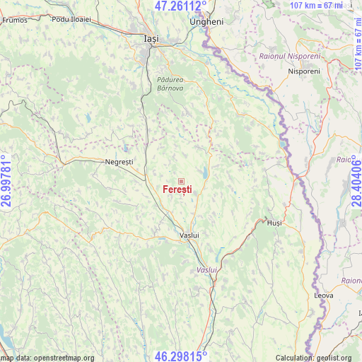
Ferești GPS coordinates[2]
46° 46' 54.444" North, 27° 42' 3.348" East
| Map corner | latitude | longitude |
|---|---|---|
| Upper-left | 47.26112°, | 26.99781° |
| Center: | 46.78179°, | 27.70093° |
| Lower-right: | 46.29815°, | 28.40406° |
| Map W x H: | 107.1×107.1 km | = 66.5×66.5mi |
| max Lat: | 48.23793° ⇑26.4% North |
| Ferești: | 46.78179° |
| min Lat: | ⇓73.6% South 43.65638° |
| min Long | Ferești | max Long |
| 20.31667° | 27.70093° | 29.65403° |
| W 93.3%⇐ | ⇒6.7% E |
Elevation
Elevation of Ferești is 168 m = 551 ft, and this is 86.9 m = 285 ft below average elevation for this country.
| Max E: |
1278 m = 4193 ft | 59.5% |
| Avg. | 254.9 m = 836 ft | |
| Ferești | 168 m = 551 ft | |
Min E: |
-2 m = -7 ft | 40.5% |
See also: Romania elevation on elevation.city.
Geographical zone
Ferești is located in North temperate zone (between Tropic of Cancer and the Arctic Circle). Distance of this North polar circle is 2199.5 km =1366.7 mi to North.| Distance of | km | miles | from Ferești |
|---|---|---|---|
| North Pole | 4805.4 | 2985.9 | to North |
| Arctic Circle | 2199.5 | 1366.7 | to North |
| Tropic Cancer | 2595.7 | 1612.9 | to South |
| Equator | 5201.6 | 3232.1 | to South |


Nearby cities:
15 places around Ferești: (largest is in red/bold)
• Codăeşti
10.1 km =6.3 mi,  21°
21°
• Draxeni
11.6 km =7.2 mi,  330°
330°
• Dăneşti
8 km =5 mi,  341°
341°
• Emil Racoviță
10.1 km =6.3 mi,  350°
350°
• Micleşti
10.8 km =6.7 mi,  68°
68°
• Moara Domnească
8.7 km =5.4 mi,  149°
149°
• Muntenii de Sus
11.8 km =7.3 mi, 150°
• Mărășeni
9.7 km =6 mi,  195°
195°
• Portari
4.8 km =3 mi,  181°
181°
• Satu Nou
10.2 km =6.3 mi,  159°
159°
• Soleşti
6.5 km =4 mi,  104°
104°
• Văleni
5.9 km =3.7 mi,  130°
130°
• Zăpodeni
5.2 km =3.2 mi,  227°
227°
• Ştefan cel Mare
9.1 km =5.7 mi,  217°
217°
• Șerbotești
6.6 km =4.1 mi,  62°
62°
Sources, notices
• [Note1] Compared only with cities in Romania existing in our database
• [Src1] Map data: © OpenStreetMap contributors (CC-BY-SA)
• [Src2] Other city data from geonames.org with taken over terms of usage.
• [Src3] Geographical zone / Annual Mean Temperature by Robert A. Rohde @ Wikipedia
