Drăgugești geodata
Drăgugești (Bacău) is a populated place; located in Romania in Europe/Bucharest (GMT+3) time zone. With population of 2,284 people, there are 2336 cities with bigger population in this country. Compared to other cities in Romania, 63.9% of cities are located further ↓South; 78.1% of cities are located further ←West and 64.2% of cities have lower elevation than Drăgugești. Note1


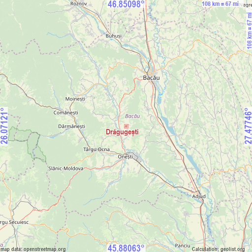
Drăgugești GPS coordinates[2]
46° 22' 4.656" North, 26° 46' 27.588" East
| Map corner | latitude | longitude |
|---|---|---|
| Upper-left | 46.85098°, | 26.07121° |
| Center: | 46.36796°, | 26.77433° |
| Lower-right: | 45.88063°, | 27.47746° |
| Map W x H: | 107.9×107.9 km | = 67×67mi |
| max Lat: | 48.23793° ⇑36.1% North |
| Drăgugești: | 46.36796° |
| min Lat: | ⇓63.9% South 43.65638° |
| min Long | Drăgugești | max Long |
| 20.31667° | 26.77433° | 29.65403° |
| W 78.1%⇐ | ⇒21.9% E |
Elevation
Elevation of Drăgugești is 285 m = 935 ft, and this is 30.1 m = 99 ft above average elevation for this country.
| Max E: |
1278 m = 4193 ft | 35.8% |
| Drăgugești | 285 m 935 ft | |
| Avg. | 254.9 m = 836 ft | |
Min E: |
-2 m = -7 ft | 64.2% |
See also: Romania elevation on elevation.city.
Geographical zone
Drăgugești is located in North temperate zone (between Tropic of Cancer and the Arctic Circle). Distance of this North polar circle is 2245.5 km =1395.3 mi to North.| Distance of | km | miles | from Drăgugești |
|---|---|---|---|
| North Pole | 4851.4 | 3014.5 | to North |
| Arctic Circle | 2245.5 | 1395.3 | to North |
| Tropic Cancer | 2549.7 | 1584.3 | to South |
| Equator | 5155.6 | 3203.5 | to South |


Nearby cities:
15 places around Drăgugești: (largest is in red/bold)
• Albele
7.8 km =4.8 mi,  267°
267°
• Brătila
4.9 km =3 mi,  179°
179°
• Bârsăneşti
6.9 km =4.3 mi,  235°
235°
• Bălăneasa
4 km =2.5 mi,  307°
307°
• Caraclău
8.1 km =5 mi,  213°
213°
• Deleni
1.6 km =1 mi,  174°
174°
• Fundu Răcăciuni
8.9 km =5.5 mi,  96°
96°
• Gura Văii
5 km =3.1 mi,  219°
219°
• Helegiu
2.7 km =1.7 mi, 223°
• Livezi
5.2 km =3.2 mi,  325°
325°
• Livezi-Vale
6.3 km =3.9 mi, 329°
• Orășa
6.5 km =4 mi,  338°
338°
• Poiana
4.9 km =3 mi,  285°
285°
• Prajoaia
6 km =3.7 mi, 314°
• Sănduleni
9.6 km =6 mi, 340°
Sources, notices
• [Note1] Compared only with cities in Romania existing in our database
• [Src1] Map data: © OpenStreetMap contributors (CC-BY-SA)
• [Src2] Other city data from geonames.org with taken over terms of usage.
• [Src3] Geographical zone / Annual Mean Temperature by Robert A. Rohde @ Wikipedia
