Coșula geodata
Coșula (Botoşani) is a seat of a second-order administrative division; located in Romania in Europe/Bucharest (GMT+3) time zone. With population of 1,303 people, there are 3519 cities with bigger population in this country. Compared to other cities in Romania, 93.6% of cities are located further ↓South; 78.2% of cities are located further ←West and 66.3% of cities have higher elevation than Coșula. Note1


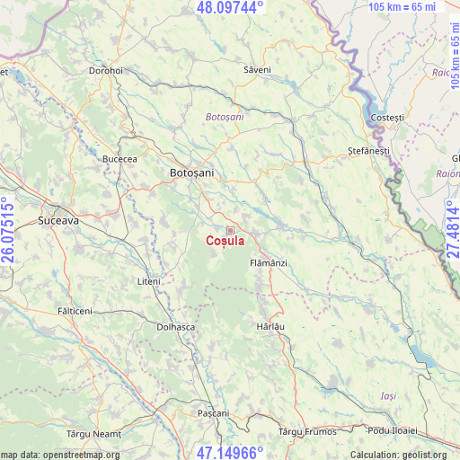
Coșula GPS coordinates[2]
47° 37' 32.52" North, 26° 46' 41.772" East
| Map corner | latitude | longitude |
|---|---|---|
| Upper-left | 48.09744°, | 26.07515° |
| Center: | 47.6257°, | 26.77827° |
| Lower-right: | 47.14966°, | 27.4814° |
| Map W x H: | 105.4×105.4 km | = 65.5×65.5mi |
| max Lat: | 48.23793° ⇑6.4% North |
| Coșula: | 47.6257° |
| min Lat: | ⇓93.6% South 43.65638° |
| min Long | Coșula | max Long |
| 20.31667° | 26.77827° | 29.65403° |
| W 78.2%⇐ | ⇒21.8% E |
Elevation
Elevation of Coșula is 142 m = 466 ft, and this is 112.9 m = 370 ft below average elevation for this country.
| Max E: |
1278 m = 4193 ft | 66.3% |
| Avg. | 254.9 m = 836 ft | |
| Coșula | 142 m = 466 ft | |
Min E: |
-2 m = -7 ft | 33.7% |
See also: Romania elevation on elevation.city.
Geographical zone
Coșula is located in North temperate zone (between Tropic of Cancer and the Arctic Circle). Distance of this North polar circle is 2105.7 km =1308.4 mi to North.| Distance of | km | miles | from Coșula |
|---|---|---|---|
| North Pole | 4711.6 | 2927.7 | to North |
| Arctic Circle | 2105.7 | 1308.4 | to North |
| Tropic Cancer | 2689.6 | 1671.2 | to South |
| Equator | 5295.5 | 3290.5 | to South |


Nearby cities:
15 places around Coșula: (largest is in red/bold)
• Băluşeni
4.8 km =3 mi,  19°
19°
• Cerbu
8.1 km =5 mi,  96°
96°
• Copălău
4.2 km =2.6 mi, 103°
• Cotu
6.9 km =4.3 mi,  116°
116°
• Cristeşti
3.5 km =2.2 mi,  284°
284°
• Draxini
3.9 km =2.4 mi,  46°
46°
• Oneaga
6.5 km =4 mi,  212°
212°
• Orășeni-Deal
9.4 km =5.8 mi,  306°
306°
• Orășeni-Vale
9.5 km =5.9 mi,  297°
297°
• Poiana
9.4 km =5.8 mi,  136°
136°
• Pădureni
1.2 km =0.7 mi,  203°
203°
• Schit-Orășeni
6.8 km =4.2 mi, 282°
• Tocileni
9.5 km =5.9 mi,  3°
3°
• Zăicești
8.2 km =5.1 mi,  330°
330°
• Șupitca
1.9 km =1.2 mi,  167°
167°
Sources, notices
• [Note1] Compared only with cities in Romania existing in our database
• [Src1] Map data: © OpenStreetMap contributors (CC-BY-SA)
• [Src2] Other city data from geonames.org with taken over terms of usage.
• [Src3] Geographical zone / Annual Mean Temperature by Robert A. Rohde @ Wikipedia
