Cornățel geodata
Cornățel (Bacău) is a populated place; located in Romania in Europe/Bucharest (GMT+3) time zone. With population of 707 people, there are 5524 cities with bigger population in this country. Compared to other cities in Romania, 58% of cities are located further ↓South; 83.8% of cities are located further ←West and 69.6% of cities have higher elevation than Cornățel. Note1


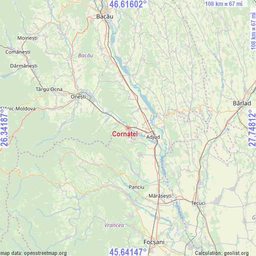
Cornățel GPS coordinates[2]
46° 7' 51.24" North, 27° 2' 41.964" East
| Map corner | latitude | longitude |
|---|---|---|
| Upper-left | 46.61602°, | 26.34187° |
| Center: | 46.1309°, | 27.04499° |
| Lower-right: | 45.64147°, | 27.74812° |
| Map W x H: | 108.4×108.4 km | = 67.4×67.4mi |
| max Lat: | 48.23793° ⇑42% North |
| Cornățel: | 46.1309° |
| min Lat: | ⇓58% South 43.65638° |
| min Long | Cornățel | max Long |
| 20.31667° | 27.04499° | 29.65403° |
| W 83.8%⇐ | ⇒16.2% E |
Elevation
Elevation of Cornățel is 129 m = 423 ft, and this is 125.9 m = 413 ft below average elevation for this country.
| Max E: |
1278 m = 4193 ft | 69.6% |
| Avg. | 254.9 m = 836 ft | |
| Cornățel | 129 m = 423 ft | |
Min E: |
-2 m = -7 ft | 30.4% |
See also: Romania elevation on elevation.city.
Geographical zone
Cornățel is located in North temperate zone (between Tropic of Cancer and the Arctic Circle). Distance of this North polar circle is 2271.9 km =1411.7 mi to North.| Distance of | km | miles | from Cornățel |
|---|---|---|---|
| North Pole | 4877.8 | 3030.9 | to North |
| Arctic Circle | 2271.9 | 1411.7 | to North |
| Tropic Cancer | 2523.4 | 1568 | to South |
| Equator | 5129.3 | 3187.2 | to South |


Nearby cities:
15 places around Cornățel: (largest is in red/bold)
• Anghelești
6 km =3.7 mi,  165°
165°
• Borșani
5.6 km =3.5 mi,  292°
292°
• Bâlca
5.4 km =3.4 mi,  276°
276°
• Conțești
5 km =3.1 mi,  37°
37°
• Copăcești
7.3 km =4.5 mi,  127°
127°
• Coţofăneşti
5.2 km =3.2 mi, 294°
• Popeni
9.6 km =6 mi,  298°
298°
• Păncești
9.1 km =5.7 mi,  11°
11°
• Rugineşti
9 km =5.6 mi,  142°
142°
• Sascut
8.8 km =5.5 mi,  28°
28°
• Sascut-Sat
6.5 km =4 mi,  16°
16°
• Schineni
8.3 km =5.2 mi, 32°
• Slobozia
6.1 km =3.8 mi,  110°
110°
• Urecheşti
3 km =1.9 mi,  84°
84°
• Viișoara
9.7 km =6 mi,  155°
155°
Sources, notices
• [Note1] Compared only with cities in Romania existing in our database
• [Src1] Map data: © OpenStreetMap contributors (CC-BY-SA)
• [Src2] Other city data from geonames.org with taken over terms of usage.
• [Src3] Geographical zone / Annual Mean Temperature by Robert A. Rohde @ Wikipedia
