Copăcele geodata
Copăcele (Caraş-Severin) is a seat of a second-order administrative division; located in Romania in Europe/Bucharest (GMT+3) time zone. With population of 1,309 people, there are 3503 cities with bigger population in this country. Compared to other cities in Romania, 55.3% of cities are located further ↑North; 93.7% of cities are located further →East and 50.5% of cities have lower elevation than Copăcele. Note1


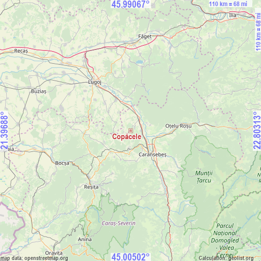
Copăcele GPS coordinates[2]
45° 30' 0" North, 22° 6' 0" East
| Map corner | latitude | longitude |
|---|---|---|
| Upper-left | 45.99067°, | 21.39688° |
| Center: | 45.5°, | 22.1° |
| Lower-right: | 45.00502°, | 22.80313° |
| Map W x H: | 109.6×109.6 km | = 68.1×68.1mi |
| max Lat: | 48.23793° ⇑55.3% North |
| Copăcele: | 45.5° |
| min Lat: | ⇓44.7% South 43.65638° |
| min Long | Copăcele | max Long |
| 20.31667° | 22.1° | 29.65403° |
| W 6.3%⇐ | ⇒93.7% E |
Elevation
Elevation of Copăcele is 214 m = 702 ft, and this is 40.9 m = 134 ft below average elevation for this country.
| Max E: |
1278 m = 4193 ft | 49.5% |
| Avg. | 254.9 m = 836 ft | |
| Copăcele | 214 m = 702 ft | |
Min E: |
-2 m = -7 ft | 50.5% |
See also: Romania elevation on elevation.city.
Geographical zone
Copăcele is located in North temperate zone (between Tropic of Cancer and the Arctic Circle). Distance of this North polar circle is 2342 km =1455.3 mi to North.| Distance of | km | miles | from Copăcele |
|---|---|---|---|
| North Pole | 4947.9 | 3074.5 | to North |
| Arctic Circle | 2342 | 1455.3 | to North |
| Tropic Cancer | 2453.2 | 1524.3 | to South |
| Equator | 5059.1 | 3143.6 | to South |


Nearby cities:
15 places around Copăcele: (largest is in red/bold)
• Brebu
12.2 km =7.6 mi,  223°
223°
• Caransebeş
13 km =8.1 mi,  135°
135°
• Constantin Daicoviciu
6.8 km =4.2 mi,  35°
35°
• Cornuțel
7.2 km =4.5 mi,  182°
182°
• Delinești
12.6 km =7.8 mi,  189°
189°
• Iaz
11.1 km =6.9 mi,  110°
110°
• Jena
11.6 km =7.2 mi,  350°
350°
• Jupa
8.4 km =5.2 mi,  124°
124°
• Obreja
11.8 km =7.3 mi,  99°
99°
• Păltiniş
8.4 km =5.2 mi,  152°
152°
• Sacu
7.5 km =4.7 mi,  9°
9°
• Zorile
3 km =1.9 mi,  255°
255°
• Zorlenţu Mare
12.5 km =7.8 mi,  243°
243°
• Zăgujeni
5.3 km =3.3 mi, 112°
• Ştiuca
12.5 km =7.8 mi,  309°
309°
Sources, notices
• [Note1] Compared only with cities in Romania existing in our database
• [Src1] Map data: © OpenStreetMap contributors (CC-BY-SA)
• [Src2] Other city data from geonames.org with taken over terms of usage.
• [Src3] Geographical zone / Annual Mean Temperature by Robert A. Rohde @ Wikipedia
