Caransebeş geodata
Caransebeş (Caraş-Severin) is a seat of a second-order administrative division; located in Romania in Europe/Bucharest (GMT+3) time zone. With population of 27,521 people, there are 80 cities with bigger population in this country. Compared to other cities in Romania, 56.7% of cities are located further ↑North; 92.6% of cities are located further →East and 51.8% of cities have higher elevation than Caransebeş. Note1


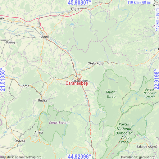
Caransebeş GPS coordinates[2]
45° 25' 0.012" North, 22° 13' 0.012" East
| Map corner | latitude | longitude |
|---|---|---|
| Upper-left | 45.90807°, | 21.51355° |
| Center: | 45.41667°, | 22.21667° |
| Lower-right: | 44.92096°, | 22.9198° |
| Map W x H: | 109.8×109.8 km | = 68.2×68.2mi |
| max Lat: | 48.23793° ⇑56.7% North |
| Caransebeş: | 45.41667° |
| min Lat: | ⇓43.3% South 43.65638° |
| min Long | Caransebeş | max Long |
| 20.31667° | 22.21667° | 29.65403° |
| W 7.4%⇐ | ⇒92.6% E |
Elevation
Elevation of Caransebeş is 202 m = 663 ft, and this is 52.9 m = 174 ft below average elevation for this country.
| Max E: |
1278 m = 4193 ft | 51.8% |
| Avg. | 254.9 m = 836 ft | |
| Caransebeş | 202 m = 663 ft | |
Min E: |
-2 m = -7 ft | 48.2% |
See also: Romania elevation on elevation.city.
Geographical zone
Caransebeş is located in North temperate zone (between Tropic of Cancer and the Arctic Circle). Distance of this North polar circle is 2351.3 km =1461 mi to North.| Distance of | km | miles | from Caransebeş |
|---|---|---|---|
| North Pole | 4957.2 | 3080.3 | to North |
| Arctic Circle | 2351.3 | 1461 | to North |
| Tropic Cancer | 2443.9 | 1518.6 | to South |
| Equator | 5049.9 | 3137.9 | to South |


Nearby cities:
15 places around Caransebeş: (largest is in red/bold)
• Bolvașnița
10.8 km =6.7 mi,  137°
137°
• Buchin
6.1 km =3.8 mi,  154°
154°
• Cornuțel
9.7 km =6 mi,  282°
282°
• Glimboca
10.8 km =6.7 mi,  46°
46°
• Iaz
5.5 km =3.4 mi,  13°
13°
• Jupa
5 km =3.1 mi,  334°
334°
• Muntele Mic
9.8 km =6.1 mi,  112°
112°
• Obreja
7.9 km =4.9 mi,  19°
19°
• Petroșnița
10.9 km =6.8 mi,  162°
162°
• Poiana
7.7 km =4.8 mi,  202°
202°
• Păltiniş
5.5 km =3.4 mi,  289°
289°
• Turnu Ruieni
9.7 km =6 mi, 107°
• Valea Timișului
8.5 km =5.3 mi, 152°
• Zervești
6 km =3.7 mi,  100°
100°
• Zăgujeni
8.4 km =5.2 mi, 329°
Sources, notices
• [Note1] Compared only with cities in Romania existing in our database
• [Src1] Map data: © OpenStreetMap contributors (CC-BY-SA)
• [Src2] Other city data from geonames.org with taken over terms of usage.
• [Src3] Geographical zone / Annual Mean Temperature by Robert A. Rohde @ Wikipedia
