Cârstieni geodata
Cârstieni (Arges) is a populated place; located in Romania in Europe/Bucharest (GMT+3) time zone. With population of 818 people, there are 4960 cities with bigger population in this country. Compared to other cities in Romania, 73.7% of cities are located further ↑North; 52.2% of cities are located further →East and 65.4% of cities have lower elevation than Cârstieni. Note1


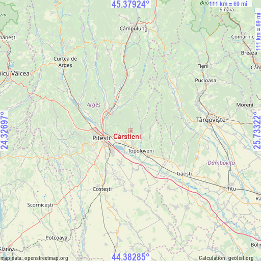
Cârstieni GPS coordinates[2]
44° 52' 59.52" North, 25° 1' 48.324" East
| Map corner | latitude | longitude |
|---|---|---|
| Upper-left | 45.37924°, | 24.32697° |
| Center: | 44.8832°, | 25.03009° |
| Lower-right: | 44.38285°, | 25.73322° |
| Map W x H: | 110.8×110.8 km | = 68.8×68.8mi |
| max Lat: | 48.23793° ⇑73.7% North |
| Cârstieni: | 44.8832° |
| min Lat: | ⇓26.3% South 43.65638° |
| min Long | Cârstieni | max Long |
| 20.31667° | 25.03009° | 29.65403° |
| W 47.8%⇐ | ⇒52.2% E |
Elevation
Elevation of Cârstieni is 292 m = 958 ft, and this is 37.1 m = 122 ft above average elevation for this country.
| Max E: |
1278 m = 4193 ft | 34.6% |
| Cârstieni | 292 m 958 ft | |
| Avg. | 254.9 m = 836 ft | |
Min E: |
-2 m = -7 ft | 65.4% |
See also: Romania elevation on elevation.city.
Geographical zone
Cârstieni is located in North temperate zone (between Tropic of Cancer and the Arctic Circle). Distance of this Northern Tropic circle is 2384.6 km =1481.7 mi to South.| Distance of | km | miles | from Cârstieni |
|---|---|---|---|
| North Pole | 5016.5 | 3117.1 | to North |
| Arctic Circle | 2410.6 | 1497.9 | to North |
| Tropic Cancer | 2384.6 | 1481.7 | to South |
| Equator | 4990.5 | 3101 | to South |


Nearby cities:
15 places around Cârstieni: (largest is in red/bold)
• Beleţi
4.6 km =2.9 mi,  65°
65°
• Ciocănești
5.9 km =3.7 mi,  233°
233°
• Gorganu
4.6 km =2.9 mi,  171°
171°
• Paraschivești
4.8 km =3 mi,  93°
93°
• Pitoi
4.2 km =2.6 mi, 89°
• Priboieni
4.2 km =2.6 mi, 89°
• Radu Negru
2.8 km =1.7 mi,  214°
214°
• Udeni-Zăvoi
6.6 km =4.1 mi,  202°
202°
• Urlucea
1.8 km =1.1 mi, 174°
• Valea Corbului
3.2 km =2 mi,  6°
6°
• Valea Popii
4.8 km =3 mi,  111°
111°
• Viișoara
6.4 km =4 mi,  240°
240°
• Vrănești
4.5 km =2.8 mi, 203°
• Văleni-Podgoria
4.3 km =2.7 mi, 228°
• Ştefăneşti
6.7 km =4.2 mi,  252°
252°
Sources, notices
• [Note1] Compared only with cities in Romania existing in our database
• [Src1] Map data: © OpenStreetMap contributors (CC-BY-SA)
• [Src2] Other city data from geonames.org with taken over terms of usage.
• [Src3] Geographical zone / Annual Mean Temperature by Robert A. Rohde @ Wikipedia
