Ştefăneşti geodata
Ştefăneşti (Arges) is a seat of a second-order administrative division; located in Romania in Europe/Bucharest (GMT+3) time zone. With population of 12,837 people, there are 149 cities with bigger population in this country. Compared to other cities in Romania, 74.4% of cities are located further ↑North; 53.4% of cities are located further →East and 64% of cities have lower elevation than Ştefăneşti. Note1


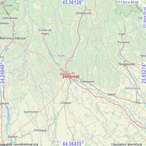
Ştefăneşti GPS coordinates[2]
44° 51' 54.216" North, 24° 56' 58.596" East
| Map corner | latitude | longitude |
|---|---|---|
| Upper-left | 45.36126°, | 24.24649° |
| Center: | 44.86506°, | 24.94961° |
| Lower-right: | 44.36455°, | 25.65274° |
| Map W x H: | 110.8×110.8 km | = 68.8×68.8mi |
| max Lat: | 48.23793° ⇑74.4% North |
| Ştefăneşti: | 44.86506° |
| min Lat: | ⇓25.6% South 43.65638° |
| min Long | Ştefăneşti | max Long |
| 20.31667° | 24.94961° | 29.65403° |
| W 46.6%⇐ | ⇒53.4% E |
Elevation
Elevation of Ştefăneşti is 284 m = 932 ft, and this is 29.1 m = 95 ft above average elevation for this country.
| Max E: |
1278 m = 4193 ft | 36% |
| Ştefăneşti | 284 m 932 ft | |
| Avg. | 254.9 m = 836 ft | |
Min E: |
-2 m = -7 ft | 64% |
See also: Romania elevation on elevation.city.
Geographical zone
Ştefăneşti is located in North temperate zone (between Tropic of Cancer and the Arctic Circle). Distance of this Northern Tropic circle is 2382.6 km =1480.5 mi to South.| Distance of | km | miles | from Ştefăneşti |
|---|---|---|---|
| North Pole | 5018.5 | 3118.4 | to North |
| Arctic Circle | 2412.6 | 1499.1 | to North |
| Tropic Cancer | 2382.6 | 1480.5 | to South |
| Equator | 4988.5 | 3099.7 | to South |


Nearby cities:
15 places around Ştefăneşti: (largest is in red/bold)
• Ciocănești
2.1 km =1.3 mi,  132°
132°
• Cârstieni
6.7 km =4.2 mi,  72°
72°
• Enculești
4.4 km =2.7 mi,  358°
358°
• Făgetu
5.5 km =3.4 mi,  326°
326°
• Golești
3.1 km =1.9 mi,  156°
156°
• Izvorani
1.2 km =0.7 mi,  323°
323°
• Mărăcineni
6.5 km =4 mi,  306°
306°
• Piteşti
6.7 km =4.2 mi,  255°
255°
• Radu Negru
4.8 km =3 mi,  93°
93°
• Udeni-Zăvoi
5.6 km =3.5 mi,  136°
136°
• Urlucea
6.5 km =4 mi, 87°
• Valea Mare-Podgoria
4.1 km =2.5 mi,  303°
303°
• Viișoara
1.4 km =0.9 mi,  146°
146°
• Vrănești
5 km =3.1 mi,  115°
115°
• Văleni-Podgoria
3.2 km =2 mi,  104°
104°
Sources, notices
• [Note1] Compared only with cities in Romania existing in our database
• [Src1] Map data: © OpenStreetMap contributors (CC-BY-SA)
• [Src2] Other city data from geonames.org with taken over terms of usage.
• [Src3] Geographical zone / Annual Mean Temperature by Robert A. Rohde @ Wikipedia
