Ceișoara geodata
Ceișoara (Bihor) is a populated place; located in Romania in Europe/Bucharest (GMT+3) time zone. With population of 763 people, there are 5224 cities with bigger population in this country. Compared to other cities in Romania, 75.5% of cities are located further ↓South; 92.7% of cities are located further →East and 59.2% of cities have higher elevation than Ceișoara. Note1


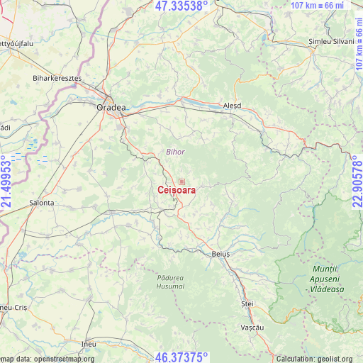
Ceișoara GPS coordinates[2]
46° 51' 24.192" North, 22° 12' 9.54" East
| Map corner | latitude | longitude |
|---|---|---|
| Upper-left | 47.33538°, | 21.49953° |
| Center: | 46.85672°, | 22.20265° |
| Lower-right: | 46.37375°, | 22.90578° |
| Map W x H: | 106.9×106.9 km | = 66.4×66.4mi |
| max Lat: | 48.23793° ⇑24.5% North |
| Ceișoara: | 46.85672° |
| min Lat: | ⇓75.5% South 43.65638° |
| min Long | Ceișoara | max Long |
| 20.31667° | 22.20265° | 29.65403° |
| W 7.3%⇐ | ⇒92.7% E |
Elevation
Elevation of Ceișoara is 169 m = 554 ft, and this is 85.9 m = 282 ft below average elevation for this country.
| Max E: |
1278 m = 4193 ft | 59.2% |
| Avg. | 254.9 m = 836 ft | |
| Ceișoara | 169 m = 554 ft | |
Min E: |
-2 m = -7 ft | 40.8% |
See also: Romania elevation on elevation.city.
Geographical zone
Ceișoara is located in North temperate zone (between Tropic of Cancer and the Arctic Circle). Distance of this North polar circle is 2191.2 km =1361.5 mi to North.| Distance of | km | miles | from Ceișoara |
|---|---|---|---|
| North Pole | 4797.1 | 2980.8 | to North |
| Arctic Circle | 2191.2 | 1361.5 | to North |
| Tropic Cancer | 2604.1 | 1618.1 | to South |
| Equator | 5210 | 3237.3 | to South |


Nearby cities:
15 places around Ceișoara: (largest is in red/bold)
• Bucuroaia
8.1 km =5 mi,  350°
350°
• Ceica
1.6 km =1 mi,  243°
243°
• Corbești
4.3 km =2.7 mi,  37°
37°
• Cotiglet
3.7 km =2.3 mi,  358°
358°
• Dobreşti
7.4 km =4.6 mi,  95°
95°
• Drăgeşti
6 km =3.7 mi,  299°
299°
• Dușești
2.8 km =1.7 mi,  219°
219°
• Hidiș
9.8 km =6.1 mi,  153°
153°
• Hidișel
4.9 km =3 mi,  120°
120°
• Holod
9.7 km =6 mi,  212°
212°
• Lupoaia
8.3 km =5.2 mi, 224°
• Sitani
9 km =5.6 mi, 122°
• Sâmbăta
6.1 km =3.8 mi,  179°
179°
• Topa de Sus
3.8 km =2.4 mi,  75°
75°
• Vărășeni
9.9 km =6.2 mi, 175°
Sources, notices
• [Note1] Compared only with cities in Romania existing in our database
• [Src1] Map data: © OpenStreetMap contributors (CC-BY-SA)
• [Src2] Other city data from geonames.org with taken over terms of usage.
• [Src3] Geographical zone / Annual Mean Temperature by Robert A. Rohde @ Wikipedia
