Căzăneşti geodata
Căzăneşti (Ialomiţa) is a seat of a second-order administrative division; located in Romania in Europe/Bucharest (GMT+3) time zone. With population of 3,604 people, there are 1374 cities with bigger population in this country. Compared to other cities in Romania, 82.4% of cities are located further ↑North; 83.1% of cities are located further ←West and 94.7% of cities have higher elevation than Căzăneşti. Note1


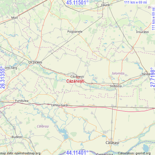
Căzăneşti GPS coordinates[2]
44° 37' 0.012" North, 27° 1' 0.012" East
| Map corner | latitude | longitude |
|---|---|---|
| Upper-left | 45.11501°, | 26.31355° |
| Center: | 44.61667°, | 27.01667° |
| Lower-right: | 44.11401°, | 27.7198° |
| Map W x H: | 111.3×111.3 km | = 69.2×69.2mi |
| max Lat: | 48.23793° ⇑82.4% North |
| Căzăneşti: | 44.61667° |
| min Lat: | ⇓17.6% South 43.65638° |
| min Long | Căzăneşti | max Long |
| 20.31667° | 27.01667° | 29.65403° |
| W 83.1%⇐ | ⇒16.9% E |
Elevation
Elevation of Căzăneşti is 36 m = 118 ft, and this is 218.9 m = 718 ft below average elevation for this country.
| Max E: |
1278 m = 4193 ft | 94.7% |
| Avg. | 254.9 m = 836 ft | |
| Căzăneşti | 36 m = 118 ft | |
Min E: |
-2 m = -7 ft | 5.3% |
See also: Romania elevation on elevation.city.
Geographical zone
Căzăneşti is located in North temperate zone (between Tropic of Cancer and the Arctic Circle). Distance of this Northern Tropic circle is 2355 km =1463.3 mi to South.| Distance of | km | miles | from Căzăneşti |
|---|---|---|---|
| North Pole | 5046.2 | 3135.6 | to North |
| Arctic Circle | 2440.3 | 1516.3 | to North |
| Tropic Cancer | 2355 | 1463.3 | to South |
| Equator | 4960.9 | 3082.6 | to South |


Nearby cities:
15 places around Căzăneşti: (largest is in red/bold)
• Albeşti
13.1 km =8.1 mi,  135°
135°
• Andrăşeşti
10.8 km =6.7 mi,  121°
121°
• Balaciu
10.7 km =6.6 mi,  279°
279°
• Bordușelu
7 km =4.3 mi,  163°
163°
• Ciochina
5.4 km =3.4 mi,  133°
133°
• Cocora
13.2 km =8.2 mi,  11°
11°
• Crunți
8.9 km =5.5 mi,  56°
56°
• Gheorghe Doja
13.5 km =8.4 mi,  90°
90°
• Marsilieni
10.4 km =6.5 mi, 144°
• Munteni Buzău
3.2 km =2 mi,  305°
305°
• Orezu
3.9 km =2.4 mi,  206°
206°
• Rași
11.6 km =7.2 mi,  218°
218°
• Reviga
12.9 km =8 mi,  30°
30°
• Rovine
10.7 km =6.6 mi, 34°
• Sărățeni
7.4 km =4.6 mi,  285°
285°
Sources, notices
• [Note1] Compared only with cities in Romania existing in our database
• [Src1] Map data: © OpenStreetMap contributors (CC-BY-SA)
• [Src2] Other city data from geonames.org with taken over terms of usage.
• [Src3] Geographical zone / Annual Mean Temperature by Robert A. Rohde @ Wikipedia
