Coroteni geodata
Coroteni (Vrancea) is a populated place; located in Romania in Europe/Bucharest (GMT+3) time zone. With population of 937 people, there are 4494 cities with bigger population in this country. Compared to other cities in Romania, 55.7% of cities are located further ↑North; 83.4% of cities are located further ←West and 62.5% of cities have lower elevation than Coroteni. Note1


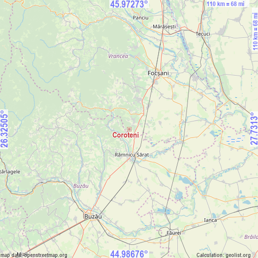
Coroteni GPS coordinates[2]
45° 28' 54.84" North, 27° 1' 41.412" East
| Map corner | latitude | longitude |
|---|---|---|
| Upper-left | 45.97273°, | 26.32505° |
| Center: | 45.4819°, | 27.02817° |
| Lower-right: | 44.98676°, | 27.7313° |
| Map W x H: | 109.6×109.6 km | = 68.1×68.1mi |
| max Lat: | 48.23793° ⇑55.7% North |
| Coroteni: | 45.4819° |
| min Lat: | ⇓44.3% South 43.65638° |
| min Long | Coroteni | max Long |
| 20.31667° | 27.02817° | 29.65403° |
| W 83.4%⇐ | ⇒16.6% E |
Elevation
Elevation of Coroteni is 277 m = 909 ft, and this is 22.1 m = 73 ft above average elevation for this country.
| Max E: |
1278 m = 4193 ft | 37.5% |
| Coroteni | 277 m 909 ft | |
| Avg. | 254.9 m = 836 ft | |
Min E: |
-2 m = -7 ft | 62.5% |
See also: Romania elevation on elevation.city.
Geographical zone
Coroteni is located in North temperate zone (between Tropic of Cancer and the Arctic Circle). Distance of this North polar circle is 2344.1 km =1456.6 mi to North.| Distance of | km | miles | from Coroteni |
|---|---|---|---|
| North Pole | 4949.9 | 3075.7 | to North |
| Arctic Circle | 2344.1 | 1456.6 | to North |
| Tropic Cancer | 2451.2 | 1523.1 | to South |
| Equator | 5057.1 | 3142.3 | to South |


Nearby cities:
15 places around Coroteni: (largest is in red/bold)
• Bordeşti
7.8 km =4.8 mi,  12°
12°
• Bordeștii de Jos
6.4 km =4 mi, 7°
• Băbeni
5.5 km =3.4 mi,  224°
224°
• Cornetu
3.2 km =2 mi,  37°
37°
• Coțatcu
2 km =1.2 mi,  211°
211°
• Dedulești
4.9 km =3 mi,  254°
254°
• Obrejița
5.2 km =3.2 mi,  66°
66°
• Oratia
4.8 km =3 mi,  189°
189°
• Podgoria
7.3 km =4.5 mi, 187°
• Pădureni
5.4 km =3.4 mi,  28°
28°
• Sihlea
7.2 km =4.5 mi, 73°
• Slimnic
3.4 km =2.1 mi, 31°
• Slobozia Bradului
2.6 km =1.6 mi, 40°
• Topliceni
7.6 km =4.7 mi,  196°
196°
• Tâmboeşti
4.2 km =2.6 mi,  23°
23°
Sources, notices
• [Note1] Compared only with cities in Romania existing in our database
• [Src1] Map data: © OpenStreetMap contributors (CC-BY-SA)
• [Src2] Other city data from geonames.org with taken over terms of usage.
• [Src3] Geographical zone / Annual Mean Temperature by Robert A. Rohde @ Wikipedia
