Brastavățu geodata
Brastavățu (Olt) is a seat of a second-order administrative division; located in Romania in Europe/Bucharest (GMT+2) time zone. With population of 4,156 people, there are 1107 cities with bigger population in this country. Compared to other cities in Romania, 98.3% of cities are located further ↑North; 61.5% of cities are located further →East and 83.8% of cities have higher elevation than Brastavățu. Note1


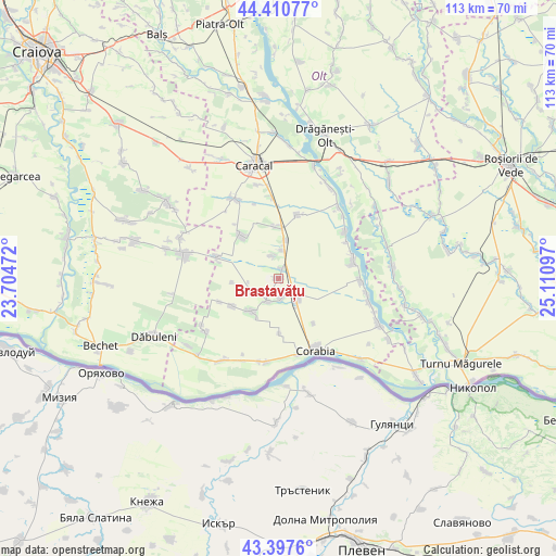
Brastavățu GPS coordinates[2]
43° 54' 22.824" North, 24° 24' 28.224" East
| Map corner | latitude | longitude |
|---|---|---|
| Upper-left | 44.41077°, | 23.70472° |
| Center: | 43.90634°, | 24.40784° |
| Lower-right: | 43.3976°, | 25.11097° |
| Map W x H: | 112.7×112.7 km | = 70×70mi |
| max Lat: | 48.23793° ⇑98.3% North |
| Brastavățu: | 43.90634° |
| min Lat: | ⇓1.7% South 43.65638° |
| min Long | Brastavățu | max Long |
| 20.31667° | 24.40784° | 29.65403° |
| W 38.5%⇐ | ⇒61.5% E |
Elevation
Elevation of Brastavățu is 82 m = 269 ft, and this is 172.9 m = 567 ft below average elevation for this country.
| Max E: |
1278 m = 4193 ft | 83.8% |
| Avg. | 254.9 m = 836 ft | |
| Brastavățu | 82 m = 269 ft | |
Min E: |
-2 m = -7 ft | 16.2% |
See also: Romania elevation on elevation.city.
Geographical zone
Brastavățu is located in North temperate zone (between Tropic of Cancer and the Arctic Circle). Distance of this Northern Tropic circle is 2276 km =1414.2 mi to South.| Distance of | km | miles | from Brastavățu |
|---|---|---|---|
| North Pole | 5125.1 | 3184.6 | to North |
| Arctic Circle | 2519.2 | 1565.4 | to North |
| Tropic Cancer | 2276 | 1414.2 | to South |
| Equator | 4881.9 | 3033.5 | to South |


Nearby cities:
15 places around Brastavățu: (largest is in red/bold)
• Arvăteasca
5.3 km =3.3 mi,  340°
340°
• Crușovu
2.1 km =1.3 mi,  15°
15°
• Câmpu Părului
9.3 km =5.8 mi,  265°
265°
• Grădinile
4.6 km =2.9 mi, 344°
• Obârşia
6.5 km =4 mi,  246°
246°
• Rotunda
11.2 km =7 mi,  319°
319°
• Studina
6.7 km =4.2 mi,  6°
6°
• Studinița
8 km =5 mi, 10°
• Tudor Vladimirescu
11.5 km =7.1 mi,  142°
142°
• Urzica
11 km =6.8 mi,  239°
239°
• Vişina
5.6 km =3.5 mi, 142°
• Vișina Nouă
3.7 km =2.3 mi,  166°
166°
• Vlădila
10.4 km =6.5 mi,  356°
356°
• Vădastra
5.5 km =3.4 mi,  216°
216°
• Vădăstriţa
8.7 km =5.4 mi, 223°
Sources, notices
• [Note1] Compared only with cities in Romania existing in our database
• [Src1] Map data: © OpenStreetMap contributors (CC-BY-SA)
• [Src2] Other city data from geonames.org with taken over terms of usage.
• [Src3] Geographical zone / Annual Mean Temperature by Robert A. Rohde @ Wikipedia
