Bogonos geodata
Bogonos (Iaşi) is a populated place; located in Romania in Europe/Bucharest (GMT+3) time zone. With population of 872 people, there are 4739 cities with bigger population in this country. Compared to other cities in Romania, 84.3% of cities are located further ↓South; 90% of cities are located further ←West and 85.1% of cities have higher elevation than Bogonos. Note1


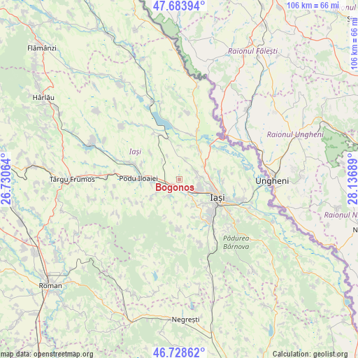
Bogonos GPS coordinates[2]
47° 12' 30.348" North, 27° 26' 1.536" East
| Map corner | latitude | longitude |
|---|---|---|
| Upper-left | 47.68394°, | 26.73064° |
| Center: | 47.20843°, | 27.43376° |
| Lower-right: | 46.72862°, | 28.13689° |
| Map W x H: | 106.2×106.2 km | = 66×66mi |
| max Lat: | 48.23793° ⇑15.7% North |
| Bogonos: | 47.20843° |
| min Lat: | ⇓84.3% South 43.65638° |
| min Long | Bogonos | max Long |
| 20.31667° | 27.43376° | 29.65403° |
| W 90%⇐ | ⇒10% E |
Elevation
Elevation of Bogonos is 78 m = 256 ft, and this is 176.9 m = 580 ft below average elevation for this country.
| Max E: |
1278 m = 4193 ft | 85.1% |
| Avg. | 254.9 m = 836 ft | |
| Bogonos | 78 m = 256 ft | |
Min E: |
-2 m = -7 ft | 14.9% |
See also: Romania elevation on elevation.city.
Geographical zone
Bogonos is located in North temperate zone (between Tropic of Cancer and the Arctic Circle). Distance of this North polar circle is 2152.1 km =1337.3 mi to North.| Distance of | km | miles | from Bogonos |
|---|---|---|---|
| North Pole | 4758 | 2956.5 | to North |
| Arctic Circle | 2152.1 | 1337.3 | to North |
| Tropic Cancer | 2643.2 | 1642.4 | to South |
| Equator | 5249.1 | 3261.6 | to South |


Nearby cities:
15 places around Bogonos: (largest is in red/bold)
• Avântu
7.3 km =4.5 mi,  317°
317°
• Breazu
6.4 km =4 mi,  85°
85°
• Cogeasca
5.9 km =3.7 mi,  218°
218°
• Dumeşti
6.9 km =4.3 mi,  246°
246°
• Hoisești
8.2 km =5.1 mi,  260°
260°
• Leţcani
3.1 km =1.9 mi,  204°
204°
• Miroslava
9 km =5.6 mi,  136°
136°
• Păușești
9.9 km =6.2 mi,  235°
235°
• Rediu
5.1 km =3.2 mi,  79°
79°
• Tăutești
3.6 km =2.2 mi,  39°
39°
• Uricani
7.3 km =4.5 mi,  146°
146°
• Valea Lupului
5.9 km =3.7 mi,  123°
123°
• Vorovești
8 km =5 mi,  163°
163°
• Vulturi
9.1 km =5.7 mi,  60°
60°
• Vânători
8 km =5 mi,  69°
69°
Sources, notices
• [Note1] Compared only with cities in Romania existing in our database
• [Src1] Map data: © OpenStreetMap contributors (CC-BY-SA)
• [Src2] Other city data from geonames.org with taken over terms of usage.
• [Src3] Geographical zone / Annual Mean Temperature by Robert A. Rohde @ Wikipedia
