Bogdand geodata
Bogdand (Satu Mare) is a seat of a second-order administrative division; located in Romania in Europe/Bucharest (GMT+3) time zone. With population of 3,179 people, there are 1632 cities with bigger population in this country. Compared to other cities in Romania, 89.2% of cities are located further ↓South; 85.4% of cities are located further →East and 57.1% of cities have higher elevation than Bogdand. Note1


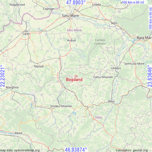
Bogdand GPS coordinates[2]
47° 25' 0.012" North, 22° 55' 59.988" East
| Map corner | latitude | longitude |
|---|---|---|
| Upper-left | 47.8903°, | 22.23021° |
| Center: | 47.41667°, | 22.93333° |
| Lower-right: | 46.93874°, | 23.63646° |
| Map W x H: | 105.8×105.8 km | = 65.7×65.7mi |
| max Lat: | 48.23793° ⇑10.8% North |
| Bogdand: | 47.41667° |
| min Lat: | ⇓89.2% South 43.65638° |
| min Long | Bogdand | max Long |
| 20.31667° | 22.93333° | 29.65403° |
| W 14.6%⇐ | ⇒85.4% E |
Elevation
Elevation of Bogdand is 178 m = 584 ft, and this is 76.9 m = 252 ft below average elevation for this country.
| Max E: |
1278 m = 4193 ft | 57.1% |
| Avg. | 254.9 m = 836 ft | |
| Bogdand | 178 m = 584 ft | |
Min E: |
-2 m = -7 ft | 42.9% |
See also: Romania elevation on elevation.city.
Geographical zone
Bogdand is located in North temperate zone (between Tropic of Cancer and the Arctic Circle). Distance of this North polar circle is 2128.9 km =1322.8 mi to North.| Distance of | km | miles | from Bogdand |
|---|---|---|---|
| North Pole | 4734.8 | 2942.1 | to North |
| Arctic Circle | 2128.9 | 1322.8 | to North |
| Tropic Cancer | 2666.3 | 1656.8 | to South |
| Equator | 5272.2 | 3276 | to South |


Nearby cities:
15 places around Bogdand: (largest is in red/bold)
• Archid
10 km =6.2 mi,  142°
142°
• Babța
4.6 km =2.9 mi,  8°
8°
• Bicaz
9.4 km =5.8 mi,  53°
53°
• Chieşd
5.3 km =3.3 mi,  225°
225°
• Corund
4.9 km =3 mi,  277°
277°
• Derșida
10.4 km =6.5 mi,  252°
252°
• Giorocuta
10.3 km =6.4 mi, 279°
• Hodod
7.7 km =4.8 mi,  103°
103°
• Hurezu Mare
9 km =5.6 mi,  307°
307°
• Nadișu Hododului
5.3 km =3.3 mi,  110°
110°
• Ser
4.8 km =3 mi,  152°
152°
• Sighetu Silvaniei
8.6 km =5.3 mi,  209°
209°
• Stâna
10.4 km =6.5 mi, 12°
• Şamşud
7.5 km =4.7 mi,  170°
170°
• Şărmăşag
10.6 km =6.6 mi, 225°
Sources, notices
• [Note1] Compared only with cities in Romania existing in our database
• [Src1] Map data: © OpenStreetMap contributors (CC-BY-SA)
• [Src2] Other city data from geonames.org with taken over terms of usage.
• [Src3] Geographical zone / Annual Mean Temperature by Robert A. Rohde @ Wikipedia
