Bobota geodata
Bobota (Sălaj) is a seat of a second-order administrative division; located in Romania in Europe/Bucharest (GMT+3) time zone. With population of 3,950 people, there are 1187 cities with bigger population in this country. Compared to other cities in Romania, 88.4% of cities are located further ↓South; 87.5% of cities are located further →East and 55.6% of cities have higher elevation than Bobota. Note1


Bobota GPS coordinates[2]
47° 22' 59.988" North, 22° 46' 0.012" East
| Map corner | latitude | longitude |
|---|---|---|
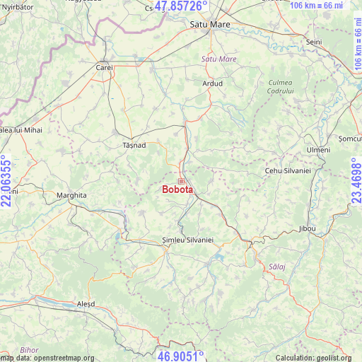
| Upper-left | 47.85726°, | 22.06355° |
| Center: | 47.38333°, | 22.76667° |
| Lower-right: | 46.9051°, | 23.4698° |
| Map W x H: | 105.9×105.9 km | = 65.8×65.8mi |
| max Lat: | 48.23793° ⇑11.6% North |
| Bobota: | 47.38333° |
| min Lat: | ⇓88.4% South 43.65638° |
| min Long | Bobota | max Long |
| 20.31667° | 22.76667° | 29.65403° |
| W 12.5%⇐ | ⇒87.5% E |
Elevation
Elevation of Bobota is 184 m = 604 ft, and this is 70.9 m = 233 ft below average elevation for this country.
| Max E: |
1278 m = 4193 ft | 55.6% |
| Avg. | 254.9 m = 836 ft | |
| Bobota | 184 m = 604 ft | |
Min E: |
-2 m = -7 ft | 44.4% |
See also: Romania elevation on elevation.city.
Geographical zone
Bobota is located in North temperate zone (between Tropic of Cancer and the Arctic Circle). Distance of this North polar circle is 2132.6 km =1325.1 mi to North.| Distance of | km | miles | from Bobota |
|---|---|---|---|
| North Pole | 4738.5 | 2944.4 | to North |
| Arctic Circle | 2132.6 | 1325.1 | to North |
| Tropic Cancer | 2662.6 | 1654.5 | to South |
| Equator | 5268.5 | 3273.7 | to South |


Nearby cities:
15 places around Bobota: (largest is in red/bold)
• Carastelec
10.5 km =6.5 mi,  208°
208°
• Chieşd
8.8 km =5.5 mi,  90°
90°
• Corund
8.8 km =5.5 mi,  60°
60°
• Derșida
2.7 km =1.7 mi,  78°
78°
• Giorocuta
5.9 km =3.7 mi,  23°
23°
• Giurtelecu Șimleului
9.9 km =6.2 mi,  167°
167°
• Hurezu Mare
10.6 km =6.6 mi,  30°
30°
• Ilișua
11 km =6.8 mi,  150°
150°
• Lompirt
9 km =5.6 mi,  138°
138°
• Măerişte
7.8 km =4.8 mi,  161°
161°
• Sighetu Silvaniei
9.1 km =5.7 mi,  114°
114°
• Supuru de Jos
9.6 km =6 mi, 15°
• Uileacu Șimleului
11.6 km =7.2 mi,  184°
184°
• Zalnoc
6.3 km =3.9 mi,  253°
253°
• Şărmăşag
6.2 km =3.9 mi,  126°
126°
Sources, notices
• [Note1] Compared only with cities in Romania existing in our database
• [Src1] Map data: © OpenStreetMap contributors (CC-BY-SA)
• [Src2] Other city data from geonames.org with taken over terms of usage.
• [Src3] Geographical zone / Annual Mean Temperature by Robert A. Rohde @ Wikipedia
