Bilbor geodata
Bilbor (Harghita) is a seat of a second-order administrative division; located in Romania in Europe/Bucharest (GMT+3) time zone. With population of 2,820 people, there are 1896 cities with bigger population in this country. Compared to other cities in Romania, 80.2% of cities are located further ↓South; 54.7% of cities are located further ←West and 99.6% of cities have lower elevation than Bilbor. Note1


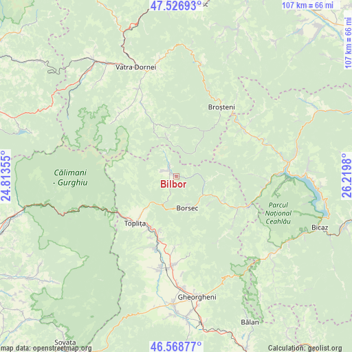
Bilbor GPS coordinates[2]
47° 3' 0" North, 25° 31' 0.012" East
| Map corner | latitude | longitude |
|---|---|---|
| Upper-left | 47.52693°, | 24.81355° |
| Center: | 47.05°, | 25.51667° |
| Lower-right: | 46.56877°, | 26.2198° |
| Map W x H: | 106.5×106.5 km | = 66.2×66.2mi |
| max Lat: | 48.23793° ⇑19.8% North |
| Bilbor: | 47.05° |
| min Lat: | ⇓80.2% South 43.65638° |
| min Long | Bilbor | max Long |
| 20.31667° | 25.51667° | 29.65403° |
| W 54.7%⇐ | ⇒45.3% E |
Elevation
Elevation of Bilbor is 958 m = 3143 ft, and this is 703.1 m = 2307 ft above average elevation for this country.
| Max E: |
1278 m = 4193 ft | 0.40000000000001% |
| Bilbor | 958 m 3143 ft | |
| Avg. | 254.9 m = 836 ft | |
Min E: |
-2 m = -7 ft | 99.6% |
See also: Romania elevation on elevation.city.
Geographical zone
Bilbor is located in North temperate zone (between Tropic of Cancer and the Arctic Circle). Distance of this North polar circle is 2169.7 km =1348.2 mi to North.| Distance of | km | miles | from Bilbor |
|---|---|---|---|
| North Pole | 4775.6 | 2967.4 | to North |
| Arctic Circle | 2169.7 | 1348.2 | to North |
| Tropic Cancer | 2625.6 | 1631.5 | to South |
| Equator | 5231.5 | 3250.7 | to South |


Nearby cities:
15 places around Bilbor: (largest is in red/bold)
• Borsec
11.7 km =7.3 mi,  161°
161°
• Capu Corbului
10.2 km =6.3 mi,  123°
123°
• Corbu
15.8 km =9.8 mi, 118°
• Călimănel
19.4 km =12.1 mi,  230°
230°
• Fundoaia
18.2 km =11.3 mi,  193°
193°
• Gălăuţaş
16.1 km =10 mi,  203°
203°
• Hodoșa
21.2 km =13.2 mi, 194°
• Jolotca
20.7 km =12.9 mi,  177°
177°
• Moglănești
17.3 km =10.7 mi,  215°
215°
• Măgheruș
19.4 km =12.1 mi, 221°
• Platonești
18.5 km =11.5 mi, 197°
• Runc
17.2 km =10.7 mi,  205°
205°
• Sărmaş
18.9 km =11.7 mi, 191°
• Vale
15.3 km =9.5 mi, 223°
• Zencani
19.5 km =12.1 mi, 225°
Sources, notices
• [Note1] Compared only with cities in Romania existing in our database
• [Src1] Map data: © OpenStreetMap contributors (CC-BY-SA)
• [Src2] Other city data from geonames.org with taken over terms of usage.
• [Src3] Geographical zone / Annual Mean Temperature by Robert A. Rohde @ Wikipedia
