Bicălatu geodata
Bicălatu (Cluj) is a populated place; located in Romania in Europe/Bucharest (GMT+3) time zone. With population of 501 people, there are 7010 cities with bigger population in this country. Compared to other cities in Romania, 76% of cities are located further ↓South; 83.6% of cities are located further →East and 84.5% of cities have lower elevation than Bicălatu. Note1


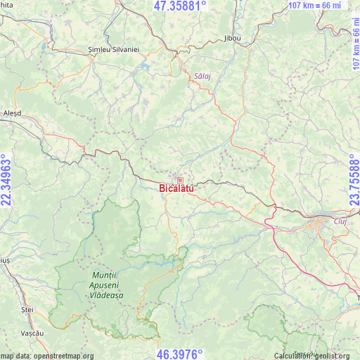
Bicălatu GPS coordinates[2]
46° 52' 49.296" North, 23° 3' 9.9" East
| Map corner | latitude | longitude |
|---|---|---|
| Upper-left | 47.35881°, | 22.34963° |
| Center: | 46.88036°, | 23.05275° |
| Lower-right: | 46.3976°, | 23.75588° |
| Map W x H: | 106.9×106.9 km | = 66.4×66.4mi |
| max Lat: | 48.23793° ⇑24% North |
| Bicălatu: | 46.88036° |
| min Lat: | ⇓76% South 43.65638° |
| min Long | Bicălatu | max Long |
| 20.31667° | 23.05275° | 29.65403° |
| W 16.4%⇐ | ⇒83.6% E |
Elevation
Elevation of Bicălatu is 440 m = 1444 ft, and this is 185.1 m = 607 ft above average elevation for this country.
| Max E: |
1278 m = 4193 ft | 15.5% |
| Bicălatu | 440 m 1444 ft | |
| Avg. | 254.9 m = 836 ft | |
Min E: |
-2 m = -7 ft | 84.5% |
See also: Romania elevation on elevation.city.
Geographical zone
Bicălatu is located in North temperate zone (between Tropic of Cancer and the Arctic Circle). Distance of this North polar circle is 2188.6 km =1359.9 mi to North.| Distance of | km | miles | from Bicălatu |
|---|---|---|---|
| North Pole | 4794.5 | 2979.2 | to North |
| Arctic Circle | 2188.6 | 1359.9 | to North |
| Tropic Cancer | 2606.7 | 1619.7 | to South |
| Equator | 5212.6 | 3239 | to South |


Nearby cities:
15 places around Bicălatu: (largest is in red/bold)
• Aghireșu
14.1 km =8.8 mi,  93°
93°
• Almaşu
9.3 km =5.8 mi,  38°
38°
• Bedeciu
11.2 km =7 mi,  147°
147°
• Călăţele
12.9 km =8 mi,  192°
192°
• Fildu de Jos
6 km =3.7 mi,  10°
10°
• Fildu de Mijloc
6.4 km =4 mi,  318°
318°
• Fildu de Sus
9 km =5.6 mi,  310°
310°
• Hodișu
11.1 km =6.9 mi,  286°
286°
• Huedin
1.5 km =0.9 mi, 187°
• Izvoru Crişului
6.3 km =3.9 mi, 145°
• Leghia
11 km =6.8 mi,  109°
109°
• Mânăstireni
12.9 km =8 mi,  169°
169°
• Petrindu
11 km =6.8 mi,  66°
66°
• Sâncraiu
7.4 km =4.6 mi,  225°
225°
• Săcuieu
14 km =8.7 mi,  243°
243°
Sources, notices
• [Note1] Compared only with cities in Romania existing in our database
• [Src1] Map data: © OpenStreetMap contributors (CC-BY-SA)
• [Src2] Other city data from geonames.org with taken over terms of usage.
• [Src3] Geographical zone / Annual Mean Temperature by Robert A. Rohde @ Wikipedia
