Beltiug geodata
Beltiug (Satu Mare) is a seat of a second-order administrative division; located in Romania in Europe/Bucharest (GMT+3) time zone. With population of 3,233 people, there are 1598 cities with bigger population in this country. Compared to other cities in Romania, 92% of cities are located further ↓South; 86.6% of cities are located further →East and 60.1% of cities have higher elevation than Beltiug. Note1


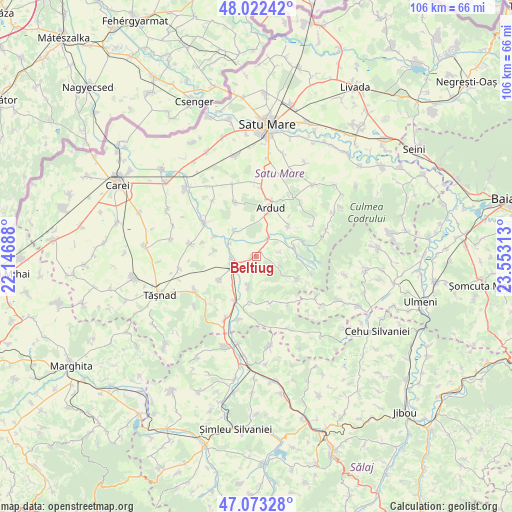
Beltiug GPS coordinates[2]
47° 33' 0" North, 22° 51' 0" East
| Map corner | latitude | longitude |
|---|---|---|
| Upper-left | 48.02242°, | 22.14688° |
| Center: | 47.55°, | 22.85° |
| Lower-right: | 47.07328°, | 23.55313° |
| Map W x H: | 105.5×105.5 km | = 65.6×65.6mi |
| max Lat: | 48.23793° ⇑8% North |
| Beltiug: | 47.55° |
| min Lat: | ⇓92% South 43.65638° |
| min Long | Beltiug | max Long |
| 20.31667° | 22.85° | 29.65403° |
| W 13.4%⇐ | ⇒86.6% E |
Elevation
Elevation of Beltiug is 166 m = 545 ft, and this is 88.9 m = 292 ft below average elevation for this country.
| Max E: |
1278 m = 4193 ft | 60.1% |
| Avg. | 254.9 m = 836 ft | |
| Beltiug | 166 m = 545 ft | |
Min E: |
-2 m = -7 ft | 39.9% |
See also: Romania elevation on elevation.city.
Geographical zone
Beltiug is located in North temperate zone (between Tropic of Cancer and the Arctic Circle). Distance of this North polar circle is 2114.1 km =1313.6 mi to North.| Distance of | km | miles | from Beltiug |
|---|---|---|---|
| North Pole | 4720 | 2932.9 | to North |
| Arctic Circle | 2114.1 | 1313.6 | to North |
| Tropic Cancer | 2681.1 | 1666 | to South |
| Equator | 5287.1 | 3285.3 | to South |


Nearby cities:
15 places around Beltiug: (largest is in red/bold)
• Acâş
5.3 km =3.3 mi,  249°
249°
• Ardud
9.6 km =6 mi,  15°
15°
• Baba Novac
11.8 km =7.3 mi,  338°
338°
• Cuța
11.9 km =7.4 mi,  95°
95°
• Dobra
6.4 km =4 mi,  195°
195°
• Gerăușa
9.4 km =5.8 mi,  46°
46°
• Ghirișa
6.6 km =4.1 mi,  320°
320°
• Hurezu Mare
9.5 km =5.9 mi,  185°
185°
• Mihăieni
8.6 km =5.3 mi,  279°
279°
• Rătești
4.3 km =2.7 mi,  34°
34°
• Socond
7.7 km =4.8 mi,  76°
76°
• Soconzel
11.8 km =7.3 mi,  107°
107°
• Stâna
9.8 km =6.1 mi,  118°
118°
• Supuru de Jos
10 km =6.2 mi, 202°
• Unimăt
9.3 km =5.8 mi,  237°
237°
Sources, notices
• [Note1] Compared only with cities in Romania existing in our database
• [Src1] Map data: © OpenStreetMap contributors (CC-BY-SA)
• [Src2] Other city data from geonames.org with taken over terms of usage.
• [Src3] Geographical zone / Annual Mean Temperature by Robert A. Rohde @ Wikipedia
