Bălaia geodata
Bălaia (Bihor) is a populated place; located in Romania in Europe/Bucharest (GMT+3) time zone. With population of 831 people, there are 4914 cities with bigger population in this country. Compared to other cities in Romania, 81.6% of cities are located further ↓South; 93% of cities are located further →East and 54.4% of cities have higher elevation than Bălaia. Note1


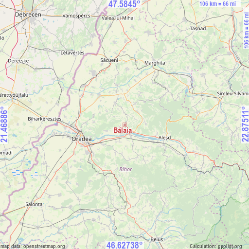
Bălaia GPS coordinates[2]
47° 6' 29.124" North, 22° 10' 19.128" East
| Map corner | latitude | longitude |
|---|---|---|
| Upper-left | 47.5845°, | 21.46886° |
| Center: | 47.10809°, | 22.17198° |
| Lower-right: | 46.62738°, | 22.87511° |
| Map W x H: | 106.4×106.4 km | = 66.1×66.1mi |
| max Lat: | 48.23793° ⇑18.4% North |
| Bălaia: | 47.10809° |
| min Lat: | ⇓81.6% South 43.65638° |
| min Long | Bălaia | max Long |
| 20.31667° | 22.17198° | 29.65403° |
| W 7%⇐ | ⇒93% E |
Elevation
Elevation of Bălaia is 190 m = 623 ft, and this is 64.9 m = 213 ft below average elevation for this country.
| Max E: |
1278 m = 4193 ft | 54.4% |
| Avg. | 254.9 m = 836 ft | |
| Bălaia | 190 m = 623 ft | |
Min E: |
-2 m = -7 ft | 45.6% |
See also: Romania elevation on elevation.city.
Geographical zone
Bălaia is located in North temperate zone (between Tropic of Cancer and the Arctic Circle). Distance of this North polar circle is 2163.2 km =1344.1 mi to North.| Distance of | km | miles | from Bălaia |
|---|---|---|---|
| North Pole | 4769.1 | 2963.4 | to North |
| Arctic Circle | 2163.2 | 1344.1 | to North |
| Tropic Cancer | 2632 | 1635.4 | to South |
| Equator | 5237.9 | 3254.7 | to South |


Nearby cities:
15 places around Bălaia: (largest is in red/bold)
• Botean
2.3 km =1.4 mi,  250°
250°
• Brusturi
7.5 km =4.7 mi,  51°
51°
• Burzuc
5.3 km =3.3 mi,  359°
359°
• Cuieșd
9.3 km =5.8 mi,  87°
87°
• Husasău de Criș
8.5 km =5.3 mi, 252°
• Ineu
5 km =3.1 mi,  236°
236°
• Orvișele
5.1 km =3.2 mi,  59°
59°
• Picleu
7.8 km =4.8 mi, 58°
• Săbolciu
4 km =2.5 mi,  201°
201°
• Săcădat
8.5 km =5.3 mi,  191°
191°
• Telechiu
9.7 km =6 mi,  127°
127°
• Tileagd
5.1 km =3.2 mi,  155°
155°
• Uileacu de Criș
4.3 km =2.7 mi, 132°
• Urvind
9.6 km =6 mi,  118°
118°
• Șișterea
9.4 km =5.8 mi,  308°
308°
Sources, notices
• [Note1] Compared only with cities in Romania existing in our database
• [Src1] Map data: © OpenStreetMap contributors (CC-BY-SA)
• [Src2] Other city data from geonames.org with taken over terms of usage.
• [Src3] Geographical zone / Annual Mean Temperature by Robert A. Rohde @ Wikipedia
