Bahnele geodata
Bahnele (Vrancea) is a populated place; located in Romania in Europe/Bucharest (GMT+3) time zone. With population of 618 people, there are 6085 cities with bigger population in this country. Compared to other cities in Romania, 53% of cities are located further ↑North; 77.1% of cities are located further ←West and 98.5% of cities have lower elevation than Bahnele. Note1


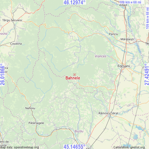
Bahnele GPS coordinates[2]
45° 38' 25.08" North, 26° 43' 18.408" East
| Map corner | latitude | longitude |
|---|---|---|
| Upper-left | 46.12974°, | 26.01866° |
| Center: | 45.6403°, | 26.72178° |
| Lower-right: | 45.14655°, | 27.42491° |
| Map W x H: | 109.3×109.3 km | = 67.9×67.9mi |
| max Lat: | 48.23793° ⇑53% North |
| Bahnele: | 45.6403° |
| min Lat: | ⇓47% South 43.65638° |
| min Long | Bahnele | max Long |
| 20.31667° | 26.72178° | 29.65403° |
| W 77.1%⇐ | ⇒22.9% E |
Elevation
Elevation of Bahnele is 817 m = 2680 ft, and this is 562.1 m = 1844 ft above average elevation for this country.
| Max E: |
1278 m = 4193 ft | 1.5% |
| Bahnele | 817 m 2680 ft | |
| Avg. | 254.9 m = 836 ft | |
Min E: |
-2 m = -7 ft | 98.5% |
See also: Romania elevation on elevation.city.
Geographical zone
Bahnele is located in North temperate zone (between Tropic of Cancer and the Arctic Circle). Distance of this North polar circle is 2326.4 km =1445.6 mi to North.| Distance of | km | miles | from Bahnele |
|---|---|---|---|
| North Pole | 4932.3 | 3064.8 | to North |
| Arctic Circle | 2326.4 | 1445.6 | to North |
| Tropic Cancer | 2468.8 | 1534 | to South |
| Equator | 5074.7 | 3153.3 | to South |


Nearby cities:
15 places around Bahnele: (largest is in red/bold)
• Andreiaşu de Jos
15 km =9.3 mi,  35°
35°
• Bisoca
12 km =7.5 mi,  188°
188°
• Chiojdeni
15.1 km =9.4 mi,  131°
131°
• Jitia
6.3 km =3.9 mi,  183°
183°
• Luncile
11.4 km =7.1 mi,  141°
141°
• Neculele
1.6 km =1 mi,  202°
202°
• Nereju
8.5 km =5.3 mi,  357°
357°
• Nereju Mic
7.6 km =4.7 mi,  344°
344°
• Paltin
15.9 km =9.9 mi, 358°
• Pleși
7.4 km =4.6 mi, 202°
• Răchitașu
12.2 km =7.6 mi,  34°
34°
• Spulber
12.8 km =8 mi,  13°
13°
• Sările
12.1 km =7.5 mi,  169°
169°
• Săruleşti
15.8 km =9.8 mi, 171°
• Vintileasca
4.6 km =2.9 mi, 168°
Sources, notices
• [Note1] Compared only with cities in Romania existing in our database
• [Src1] Map data: © OpenStreetMap contributors (CC-BY-SA)
• [Src2] Other city data from geonames.org with taken over terms of usage.
• [Src3] Geographical zone / Annual Mean Temperature by Robert A. Rohde @ Wikipedia
