Adășeni geodata
Adășeni (Botoşani) is a seat of a second-order administrative division; located in Romania in Europe/Bucharest (GMT+3) time zone. With population of 1,167 people, there are 3807 cities with bigger population in this country. Compared to other cities in Romania, 99.5% of cities are located further ↓South; 81.9% of cities are located further ←West and 54.8% of cities have higher elevation than Adășeni. Note1


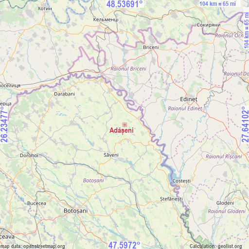
Adășeni GPS coordinates[2]
48° 4' 9.12" North, 26° 56' 16.404" East
| Map corner | latitude | longitude |
|---|---|---|
| Upper-left | 48.53691°, | 26.23477° |
| Center: | 48.0692°, | 26.93789° |
| Lower-right: | 47.5972°, | 27.64102° |
| Map W x H: | 104.5×104.5 km | = 64.9×64.9mi |
| max Lat: | 48.23793° ⇑0.5% North |
| Adășeni: | 48.0692° |
| min Lat: | ⇓99.5% South 43.65638° |
| min Long | Adășeni | max Long |
| 20.31667° | 26.93789° | 29.65403° |
| W 81.9%⇐ | ⇒18.1% E |
Elevation
Elevation of Adășeni is 188 m = 617 ft, and this is 66.9 m = 219 ft below average elevation for this country.
| Max E: |
1278 m = 4193 ft | 54.8% |
| Avg. | 254.9 m = 836 ft | |
| Adășeni | 188 m = 617 ft | |
Min E: |
-2 m = -7 ft | 45.2% |
See also: Romania elevation on elevation.city.
Geographical zone
Adășeni is located in North temperate zone (between Tropic of Cancer and the Arctic Circle). Distance of this North polar circle is 2056.4 km =1277.8 mi to North.| Distance of | km | miles | from Adășeni |
|---|---|---|---|
| North Pole | 4662.3 | 2897 | to North |
| Arctic Circle | 2056.4 | 1277.8 | to North |
| Tropic Cancer | 2738.9 | 1701.9 | to South |
| Equator | 5344.8 | 3321.1 | to South |


Nearby cities:
15 places around Adășeni: (largest is in red/bold)
• Aurel Vlaicu
7.8 km =4.8 mi,  194°
194°
• Avrămeni
5.9 km =3.7 mi,  171°
171°
• Codreni
11.6 km =7.2 mi,  283°
283°
• Coţuşca
9.7 km =6 mi,  317°
317°
• Crasnaleuca
9.9 km =6.2 mi,  8°
8°
• Drăguşeni
10.7 km =6.6 mi,  237°
237°
• Flondora
10.2 km =6.3 mi,  136°
136°
• Ghireni
10 km =6.2 mi,  337°
337°
• Horia
6.5 km =4 mi,  24°
24°
• Liveni
9.4 km =5.8 mi,  98°
98°
• Mitoc
7.9 km =4.9 mi,  64°
64°
• Nichiteni
6.3 km =3.9 mi,  297°
297°
• Podriga
10.5 km =6.5 mi,  227°
227°
• Puțureni
9.1 km =5.7 mi, 302°
• Tudor Vladimirescu
10.2 km =6.3 mi,  154°
154°
Sources, notices
• [Note1] Compared only with cities in Romania existing in our database
• [Src1] Map data: © OpenStreetMap contributors (CC-BY-SA)
• [Src2] Other city data from geonames.org with taken over terms of usage.
• [Src3] Geographical zone / Annual Mean Temperature by Robert A. Rohde @ Wikipedia
