Podriga geodata
Podriga (Botoşani) is a populated place; located in Romania in Europe/Bucharest (GMT+3) time zone. With population of 1,000 people, there are 4293 cities with bigger population in this country. Compared to other cities in Romania, 99.2% of cities are located further ↓South; 79.5% of cities are located further ←West and 76.7% of cities have higher elevation than Podriga. Note1


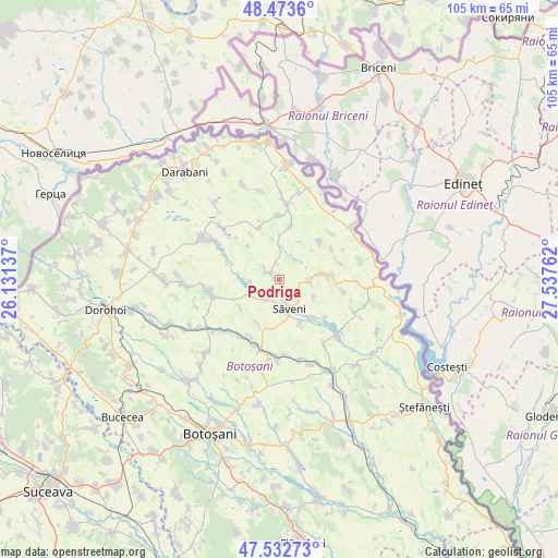
Podriga GPS coordinates[2]
48° 0' 19.116" North, 26° 50' 4.164" East
| Map corner | latitude | longitude |
|---|---|---|
| Upper-left | 48.4736°, | 26.13137° |
| Center: | 48.00531°, | 26.83449° |
| Lower-right: | 47.53273°, | 27.53762° |
| Map W x H: | 104.6×104.6 km | = 65×65mi |
| max Lat: | 48.23793° ⇑0.8% North |
| Podriga: | 48.00531° |
| min Lat: | ⇓99.2% South 43.65638° |
| min Long | Podriga | max Long |
| 20.31667° | 26.83449° | 29.65403° |
| W 79.5%⇐ | ⇒20.5% E |
Elevation
Elevation of Podriga is 105 m = 344 ft, and this is 149.9 m = 492 ft below average elevation for this country.
| Max E: |
1278 m = 4193 ft | 76.7% |
| Avg. | 254.9 m = 836 ft | |
| Podriga | 105 m = 344 ft | |
Min E: |
-2 m = -7 ft | 23.3% |
See also: Romania elevation on elevation.city.
Geographical zone
Podriga is located in North temperate zone (between Tropic of Cancer and the Arctic Circle). Distance of this North polar circle is 2063.5 km =1282.2 mi to North.| Distance of | km | miles | from Podriga |
|---|---|---|---|
| North Pole | 4669.4 | 2901.4 | to North |
| Arctic Circle | 2063.5 | 1282.2 | to North |
| Tropic Cancer | 2731.8 | 1697.5 | to South |
| Equator | 5337.7 | 3316.7 | to South |


Nearby cities:
15 places around Podriga: (largest is in red/bold)
• Adășeni
10.5 km =6.5 mi,  47°
47°
• Aurel Vlaicu
5.7 km =3.5 mi,  94°
94°
• Avrămeni
8.7 km =5.4 mi,  81°
81°
• Borzești
12 km =7.5 mi,  209°
209°
• Chișcăreni
4.9 km =3 mi,  182°
182°
• Codreni
10.5 km =6.5 mi,  339°
339°
• Drăguşeni
1.8 km =1.1 mi,  313°
313°
• Mihai Viteazu
9.4 km =5.8 mi,  204°
204°
• Negreni
5.6 km =3.5 mi,  263°
263°
• Nichiteni
10.2 km =6.3 mi,  11°
11°
• Petricani
5.5 km =3.4 mi,  173°
173°
• Sârbi
9.3 km =5.8 mi,  138°
138°
• Săveni
6.6 km =4.1 mi,  158°
158°
• Vlăsineşti
8.8 km =5.5 mi, 155°
• Ştiubieni
5.7 km =3.5 mi,  221°
221°
Sources, notices
• [Note1] Compared only with cities in Romania existing in our database
• [Src1] Map data: © OpenStreetMap contributors (CC-BY-SA)
• [Src2] Other city data from geonames.org with taken over terms of usage.
• [Src3] Geographical zone / Annual Mean Temperature by Robert A. Rohde @ Wikipedia
