Kuštilj geodata
Kuštilj (Vojvodina) is a populated place; located in Serbia in Europe/Belgrade (GMT+2) time zone. With population of 1,189 people, there are 302 cities with bigger population in this country. Compared to other cities in Serbia, 59.6% of cities are located further ↓South; 83.7% of cities are located further ←West and 51.2% of cities have higher elevation than Kuštilj. Note1


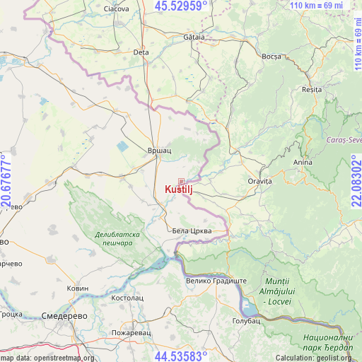
Kuštilj GPS coordinates[2]
45° 2' 5.532" North, 21° 22' 47.604" East
| Map corner | latitude | longitude |
|---|---|---|
| Upper-left | 45.52959°, | 20.67677° |
| Center: | 45.03487°, | 21.37989° |
| Lower-right: | 44.53583°, | 22.08302° |
| Map W x H: | 110.5×110.5 km | = 68.7×68.7mi |
| max Lat: | 46.1° ⇑40.4% North |
| Kuštilj: | 45.03487° |
| min Lat: | ⇓59.6% South 42.25846° |
| min Long | Kuštilj | max Long |
| 18.9276° | 21.37989° | 22.77556° |
| W 83.7%⇐ | ⇒16.3% E |
Elevation
Elevation of Kuštilj is 88 m = 289 ft, and this is 88.4 m = 290 ft below average elevation for this country.
| Max E: |
1421 m = 4662 ft | 51.2% |
| Avg. | 176.4 m = 579 ft | |
| Kuštilj | 88 m = 289 ft | |
Min E: |
49 m = 161 ft | 48.8% |
See also: Serbia elevation on elevation.city.
Geographical zone
Kuštilj is located in North temperate zone (between Tropic of Cancer and the Arctic Circle). Distance of this North polar circle is 2393.8 km =1487.4 mi to North.| Distance of | km | miles | from Kuštilj |
|---|---|---|---|
| North Pole | 4999.7 | 3106.7 | to North |
| Arctic Circle | 2393.8 | 1487.4 | to North |
| Tropic Cancer | 2401.5 | 1492.2 | to South |
| Equator | 5007.4 | 3111.5 | to South |


Nearby cities:
15 places around Kuštilj: (largest is in red/bold)
• Bela Crkva
15.6 km =9.7 mi,  169°
169°
• Gudurica
15.6 km =9.7 mi,  18°
18°
• Izbište
15.5 km =9.6 mi,  264°
264°
• Jablanka
4.6 km =2.9 mi,  10°
10°
• Mali Žam
19.7 km =12.2 mi,  350°
350°
• Margita
25.8 km =16 mi,  321°
321°
• Markovac
14.7 km =9.1 mi,  29°
29°
• Nikolinci
24.7 km =15.3 mi,  274°
274°
• Pavliš
13.5 km =8.4 mi,  305°
305°
• Ritiševo
12.4 km =7.7 mi,  285°
285°
• Uljma
17.8 km =11.1 mi, 272°
• Veliko Središte
16.2 km =10.1 mi, 6°
• Vlajkovac
14.8 km =9.2 mi, 286°
• Vojvodinci
3.3 km =2.1 mi,  229°
229°
• Vršac
10.9 km =6.8 mi,  326°
326°
Sources, notices
• [Note1] Compared only with cities in Serbia existing in our database
• [Src1] Map data: © OpenStreetMap contributors (CC-BY-SA)
• [Src2] Other city data from geonames.org with taken over terms of usage.
• [Src3] Geographical zone / Annual Mean Temperature by Robert A. Rohde @ Wikipedia
