Gudurica geodata
Gudurica (Vojvodina) is a populated place; located in Serbia in Europe/Belgrade (GMT+2) time zone. With population of 1,448 people, there are 269 cities with bigger population in this country. Compared to other cities in Serbia, 66.9% of cities are located further ↓South; 85.7% of cities are located further ←West and 61.9% of cities have lower elevation than Gudurica. Note1


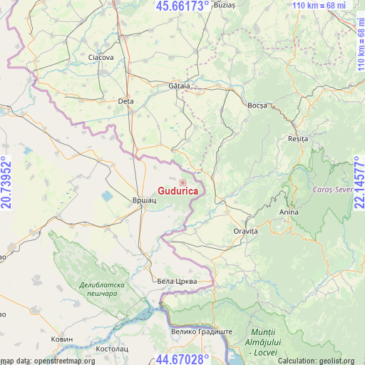
Gudurica GPS coordinates[2]
45° 10' 5.376" North, 21° 26' 33.504" East
| Map corner | latitude | longitude |
|---|---|---|
| Upper-left | 45.66173°, | 20.73952° |
| Center: | 45.16816°, | 21.44264° |
| Lower-right: | 44.67028°, | 22.14577° |
| Map W x H: | 110.2×110.2 km | = 68.5×68.5mi |
| max Lat: | 46.1° ⇑33.1% North |
| Gudurica: | 45.16816° |
| min Lat: | ⇓66.9% South 42.25846° |
| min Long | Gudurica | max Long |
| 18.9276° | 21.44264° | 22.77556° |
| W 85.7%⇐ | ⇒14.3% E |
Elevation
Elevation of Gudurica is 115 m = 377 ft, and this is 61.4 m = 201 ft below average elevation for this country.
| Max E: |
1421 m = 4662 ft | 38.1% |
| Avg. | 176.4 m = 579 ft | |
| Gudurica | 115 m = 377 ft | |
Min E: |
49 m = 161 ft | 61.9% |
See also: Serbia elevation on elevation.city.
Geographical zone
Gudurica is located in North temperate zone (between Tropic of Cancer and the Arctic Circle). Distance of this North polar circle is 2378.9 km =1478.2 mi to North.| Distance of | km | miles | from Gudurica |
|---|---|---|---|
| North Pole | 4984.8 | 3097.4 | to North |
| Arctic Circle | 2378.9 | 1478.2 | to North |
| Tropic Cancer | 2416.3 | 1501.4 | to South |
| Equator | 5022.2 | 3120.6 | to South |


Nearby cities:
15 places around Gudurica: (largest is in red/bold)
• Izbište
26 km =16.2 mi,  231°
231°
• Jablanka
11.1 km =6.9 mi,  201°
201°
• Kuštilj
15.6 km =9.7 mi, 198°
• Mali Žam
9.5 km =5.9 mi,  299°
299°
• Margita
21.6 km =13.4 mi,  284°
284°
• Markovac
3.1 km =1.9 mi,  131°
131°
• Pavliš
17.4 km =10.8 mi,  246°
246°
• Plandište
26 km =16.2 mi, 284°
• Ritiševo
20.4 km =12.7 mi,  235°
235°
• Uljma
26.6 km =16.5 mi, 238°
• Veliki Gaj
25.2 km =15.7 mi, 302°
• Veliko Središte
3.3 km =2.1 mi,  291°
291°
• Vlajkovac
21.9 km =13.6 mi, 240°
• Vojvodinci
18.5 km =11.5 mi, 203°
• Vršac
12.3 km =7.6 mi, 242°
Sources, notices
• [Note1] Compared only with cities in Serbia existing in our database
• [Src1] Map data: © OpenStreetMap contributors (CC-BY-SA)
• [Src2] Other city data from geonames.org with taken over terms of usage.
• [Src3] Geographical zone / Annual Mean Temperature by Robert A. Rohde @ Wikipedia
