Alibunar geodata
Alibunar (Vojvodina) is a seat of a third-order administrative division; located in Serbia in Europe/Belgrade (GMT+2) time zone. With population of 3,803 people, there are 117 cities with bigger population in this country. Compared to other cities in Serbia, 62.6% of cities are located further ↓South; 73.7% of cities are located further ←West and 56.5% of cities have higher elevation than Alibunar. Note1


Alibunar GPS coordinates[2]
45° 4' 50.988" North, 20° 57' 56.988" East
| Map corner | latitude | longitude |
|---|---|---|
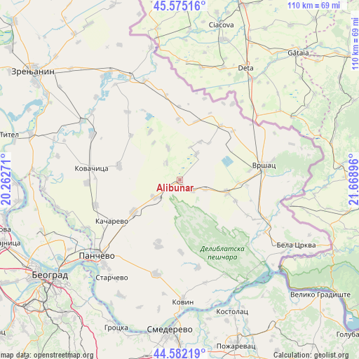
| Upper-left | 45.57516°, | 20.26271° |
| Center: | 45.08083°, | 20.96583° |
| Lower-right: | 44.58219°, | 21.66896° |
| Map W x H: | 110.4×110.4 km | = 68.6×68.6mi |
| max Lat: | 46.1° ⇑37.4% North |
| Alibunar: | 45.08083° |
| min Lat: | ⇓62.6% South 42.25846° |
| min Long | Alibunar | max Long |
| 18.9276° | 20.96583° | 22.77556° |
| W 73.7%⇐ | ⇒26.3% E |
Elevation
Elevation of Alibunar is 84 m = 276 ft, and this is 92.4 m = 303 ft below average elevation for this country.
| Max E: |
1421 m = 4662 ft | 56.5% |
| Avg. | 176.4 m = 579 ft | |
| Alibunar | 84 m = 276 ft | |
Min E: |
49 m = 161 ft | 43.5% |
See also: Serbia elevation on elevation.city.
Geographical zone
Alibunar is located in North temperate zone (between Tropic of Cancer and the Arctic Circle). Distance of this North polar circle is 2388.7 km =1484.3 mi to North.| Distance of | km | miles | from Alibunar |
|---|---|---|---|
| North Pole | 4994.5 | 3103.4 | to North |
| Arctic Circle | 2388.7 | 1484.3 | to North |
| Tropic Cancer | 2406.6 | 1495.4 | to South |
| Equator | 5012.5 | 3114.6 | to South |


Nearby cities:
15 places around Alibunar: (largest is in red/bold)
• Banatski Karlovac
5.4 km =3.4 mi,  130°
130°
• Barice
14.5 km =9 mi,  39°
39°
• Dobrica
17.3 km =10.7 mi,  328°
328°
• Hajdučica
18.8 km =11.7 mi,  358°
358°
• Ilandža
10.4 km =6.5 mi,  339°
339°
• Izbište
18.3 km =11.4 mi,  110°
110°
• Janošik
10.6 km =6.6 mi,  17°
17°
• Jermenovci
13.3 km =8.3 mi,  28°
28°
• Kozjak
13.9 km =8.6 mi,  324°
324°
• Lokve
9.4 km =5.8 mi, 32°
• Nikolinci
8.5 km =5.3 mi, 111°
• Seleuš
6.6 km =4.1 mi, 322°
• Uljma
15.4 km =9.6 mi, 106°
• Vladimirovac
9.6 km =6 mi,  234°
234°
• Vlajkovac
18.4 km =11.4 mi,  93°
93°
Sources, notices
• [Note1] Compared only with cities in Serbia existing in our database
• [Src1] Map data: © OpenStreetMap contributors (CC-BY-SA)
• [Src2] Other city data from geonames.org with taken over terms of usage.
• [Src3] Geographical zone / Annual Mean Temperature by Robert A. Rohde @ Wikipedia
