Angarsk geodata
Angarsk (Irkutsk Oblast) is a populated place; located in Russia in Asia/Irkutsk (GMT+8) time zone. With population of 243,158 people, there are 78 cities with bigger population in this country. Compared to other cities in Russia, 66% of cities are located further ↑North; 89.2% of cities are located further ←West and 89.4% of cities have lower elevation than Angarsk. Note1


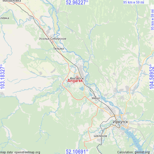
Angarsk GPS coordinates[2]
52° 32' 12.012" North, 103° 53' 11.004" East
| Map corner | latitude | longitude |
|---|---|---|
| Upper-left | 52.96227°, | 103.18327° |
| Center: | 52.53667°, | 103.88639° |
| Lower-right: | 52.10691°, | 104.58952° |
| Map W x H: | 95.1×95.1 km | = 59.1×59.1mi |
| max Lat: | 73.50819° ⇑66% North |
| Angarsk: | 52.53667° |
| min Lat: | ⇓34% South 41.28413° |
| min Long | Angarsk | max Long |
| -179.12198° | 103.88639° | 179.35046° |
| W 89.2%⇐ | ⇒10.8% E |
Elevation
Elevation of Angarsk is 437 m = 1434 ft, and this is 234.4 m = 769 ft above average elevation for this country.
| Max E: |
2518 m = 8261 ft | 10.6% |
| Angarsk | 437 m 1434 ft | |
| Avg. | 202.6 m = 665 ft | |
Min E: |
-28 m = -92 ft | 89.4% |
See also: Angarsk elevation on elevation.city.
Geographical zone
Angarsk is located in North temperate zone (between Tropic of Cancer and the Arctic Circle). Distance of this North polar circle is 1559.6 km =969.1 mi to North.| Distance of | km | miles | from Angarsk |
|---|---|---|---|
| North Pole | 4165.5 | 2588.3 | to North |
| Arctic Circle | 1559.6 | 969.1 | to North |
| Tropic Cancer | 3235.6 | 2010.5 | to South |
| Equator | 5841.5 | 3629.7 | to South |


Nearby cities:
15 places around Angarsk: (largest is in red/bold)
• Baklashi
36.3 km =22.6 mi,  162°
162°
• Chistyye Klyuchi
39.9 km =24.8 mi,  173°
173°
• Dzerzhinsk
44.3 km =27.5 mi,  130°
130°
• Irkutsk
38.5 km =23.9 mi, 133°
• Khomutovo
35.8 km =22.2 mi,  102°
102°
• Kitoy
7.1 km =4.4 mi,  7°
7°
• Markova
42.6 km =26.5 mi,  148°
148°
• Meget
17.5 km =10.9 mi,  140°
140°
• Oyëk
38.9 km =24.2 mi,  81°
81°
• Shelekhov
38.7 km =24 mi, 158°
• Smolenshchina
35.3 km =21.9 mi, 152°
• Tel’ma
21.4 km =13.3 mi,  327°
327°
• Urik
25.4 km =15.8 mi,  109°
109°
• Usol’ye-Sibirskoye
28.9 km =18 mi, 325°
• Vvedenshchina
36.8 km =22.9 mi, 173°
Sources, notices
• [Note1] Compared only with cities in Russia existing in our database
• [Src1] Map data: © OpenStreetMap contributors (CC-BY-SA)
• [Src2] Other city data from geonames.org with taken over terms of usage.
• [Src3] Geographical zone / Annual Mean Temperature by Robert A. Rohde @ Wikipedia
