Tel’ma geodata
Tel’ma (Irkutsk Oblast) is a populated place; located in Russia in Asia/Irkutsk (GMT+8) time zone. With population of 4,600 people, there are 2821 cities with bigger population in this country. Compared to other cities in Russia, 64.8% of cities are located further ↑North; 89.1% of cities are located further ←West and 88.3% of cities have lower elevation than Tel’ma. Note1


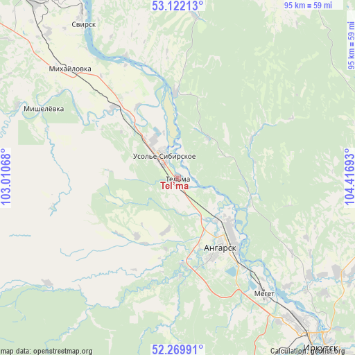
Tel’ma GPS coordinates[2]
52° 41' 53.16" North, 103° 42' 49.68" East
| Map corner | latitude | longitude |
|---|---|---|
| Upper-left | 53.12213°, | 103.01068° |
| Center: | 52.6981°, | 103.7138° |
| Lower-right: | 52.26991°, | 104.41693° |
| Map W x H: | 94.8×94.8 km | = 58.9×58.9mi |
| max Lat: | 73.50819° ⇑64.8% North |
| Tel’ma: | 52.6981° |
| min Lat: | ⇓35.2% South 41.28413° |
| min Long | Tel’ma | max Long |
| -179.12198° | 103.7138° | 179.35046° |
| W 89.1%⇐ | ⇒10.9% E |
Elevation
Elevation of Tel’ma is 406 m = 1332 ft, and this is 203.4 m = 667 ft above average elevation for this country.
| Max E: |
2518 m = 8261 ft | 11.7% |
| Tel’ma | 406 m 1332 ft | |
| Avg. | 202.6 m = 665 ft | |
Min E: |
-28 m = -92 ft | 88.3% |
See also: Russia elevation on elevation.city.
Geographical zone
Tel’ma is located in North temperate zone (between Tropic of Cancer and the Arctic Circle). Distance of this North polar circle is 1541.7 km =958 mi to North.| Distance of | km | miles | from Tel’ma |
|---|---|---|---|
| North Pole | 4147.6 | 2577.2 | to North |
| Arctic Circle | 1541.7 | 958 | to North |
| Tropic Cancer | 3253.6 | 2021.7 | to South |
| Equator | 5859.5 | 3640.9 | to South |


Nearby cities:
15 places around Tel’ma: (largest is in red/bold)
• Angarsk
21.4 km =13.3 mi,  147°
147°
• Baklashi
57.2 km =35.5 mi,  156°
156°
• Bokhan
50.7 km =31.5 mi,  4°
4°
• Khomutovo
53.2 km =33.1 mi,  119°
119°
• Kitoy
16.6 km =10.3 mi,  130°
130°
• Meget
38.8 km =24.1 mi,  144°
144°
• Mishelevka
40.5 km =25.2 mi,  295°
295°
• Oyëk
51.6 km =32.1 mi,  103°
103°
• Smolenshchina
56.7 km =35.2 mi, 150°
• Sredniy
25.9 km =16.1 mi,  324°
324°
• Svirsk
50.1 km =31.1 mi,  329°
329°
• Tayturka
25.5 km =15.8 mi, 318°
• Urik
44.3 km =27.5 mi, 126°
• Usol’ye-Sibirskoye
7.6 km =4.7 mi, 322°
• Vvedenshchina
56.8 km =35.3 mi, 164°
Sources, notices
• [Note1] Compared only with cities in Russia existing in our database
• [Src1] Map data: © OpenStreetMap contributors (CC-BY-SA)
• [Src2] Other city data from geonames.org with taken over terms of usage.
• [Src3] Geographical zone / Annual Mean Temperature by Robert A. Rohde @ Wikipedia
