Zhemtala geodata
Zhemtala (Kabardino-Balkariya Republic) is a populated place; located in Russia in Europe/Moscow (GMT+3) time zone. With population of 3,266 people, there are 3553 cities with bigger population in this country. Compared to other cities in Russia, 95.5% of cities are located further ↑North; 54% of cities are located further →East and 97.1% of cities have lower elevation than Zhemtala. Note1


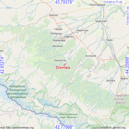
Zhemtala GPS coordinates[2]
43° 17' 2.688" North, 43° 39' 21.096" East
| Map corner | latitude | longitude |
|---|---|---|
| Upper-left | 43.79378°, | 42.95274° |
| Center: | 43.28408°, | 43.65586° |
| Lower-right: | 42.77008°, | 44.35899° |
| Map W x H: | 113.8×113.8 km | = 70.7×70.7mi |
| max Lat: | 73.50819° ⇑95.5% North |
| Zhemtala: | 43.28408° |
| min Lat: | ⇓4.5% South 41.28413° |
| min Long | Zhemtala | max Long |
| -179.12198° | 43.65586° | 179.35046° |
| W 46%⇐ | ⇒54% E |
Elevation
Elevation of Zhemtala is 771 m = 2530 ft, and this is 568.4 m = 1865 ft above average elevation for this country.
| Max E: |
2518 m = 8261 ft | 2.9% |
| Zhemtala | 771 m 2530 ft | |
| Avg. | 202.6 m = 665 ft | |
Min E: |
-28 m = -92 ft | 97.1% |
See also: Russia elevation on elevation.city.
Geographical zone
Zhemtala is located in North temperate zone (between Tropic of Cancer and the Arctic Circle). Distance of this Northern Tropic circle is 2206.8 km =1371.2 mi to South.| Distance of | km | miles | from Zhemtala |
|---|---|---|---|
| North Pole | 5194.3 | 3227.6 | to North |
| Arctic Circle | 2588.4 | 1608.4 | to North |
| Tropic Cancer | 2206.8 | 1371.2 | to South |
| Equator | 4812.7 | 2990.5 | to South |


Nearby cities:
15 places around Zhemtala: (largest is in red/bold)
• Aleksandrovskaya
22.2 km =13.8 mi,  358°
358°
• Argudan
26 km =16.2 mi,  54°
54°
• Aushiger
13.9 km =8.6 mi,  26°
26°
• Babugent
8.6 km =5.3 mi,  266°
266°
• Belaya Rechka
19.7 km =12.2 mi,  330°
330°
• Chikola
23.9 km =14.9 mi,  115°
115°
• Kashkhatau
5.4 km =3.4 mi,  314°
314°
• Kenzhe
25.5 km =15.8 mi,  341°
341°
• Nal’chik
24 km =14.9 mi,  352°
352°
• Nartan
25.5 km =15.8 mi,  7°
7°
• Psygansu
18.7 km =11.6 mi,  36°
36°
• Staryy Cherek
25.9 km =16.1 mi, 36°
• Urvan’
24.6 km =15.3 mi,  20°
20°
• Verkhnyaya Balkariya
23.9 km =14.9 mi,  222°
222°
• Vol’nyy Aul
21.8 km =13.5 mi, 353°
Sources, notices
• [Note1] Compared only with cities in Russia existing in our database
• [Src1] Map data: © OpenStreetMap contributors (CC-BY-SA)
• [Src2] Other city data from geonames.org with taken over terms of usage.
• [Src3] Geographical zone / Annual Mean Temperature by Robert A. Rohde @ Wikipedia
