Zhavoronki geodata
Zhavoronki (Moscow Oblast) is a populated place; located in Russia in Europe/Moscow (GMT+3) time zone. With population of 2,899 people, there are 3825 cities with bigger population in this country. Compared to other cities in Russia, 60.7% of cities are located further ↓South; 84.6% of cities are located further →East and 69.2% of cities have lower elevation than Zhavoronki. Note1


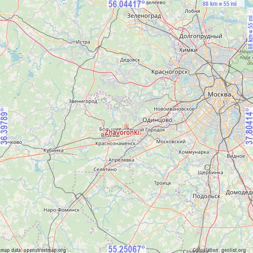
Zhavoronki GPS coordinates[2]
55° 38' 57.948" North, 37° 6' 3.636" East
| Map corner | latitude | longitude |
|---|---|---|
| Upper-left | 56.04417°, | 36.39789° |
| Center: | 55.64943°, | 37.10101° |
| Lower-right: | 55.25067°, | 37.80414° |
| Map W x H: | 88.2×88.2 km | = 54.8×54.8mi |
| max Lat: | 73.50819° ⇑39.3% North |
| Zhavoronki: | 55.64943° |
| min Lat: | ⇓60.7% South 41.28413° |
| min Long | Zhavoronki | max Long |
| -179.12198° | 37.10101° | 179.35046° |
| W 15.4%⇐ | ⇒84.6% E |
Elevation
Elevation of Zhavoronki is 195 m = 640 ft, and this is 7.6 m = 25 ft below average elevation for this country.
| Max E: |
2518 m = 8261 ft | 30.8% |
| Avg. | 202.6 m = 665 ft | |
| Zhavoronki | 195 m = 640 ft | |
Min E: |
-28 m = -92 ft | 69.2% |
See also: Russia elevation on elevation.city.
Geographical zone
Zhavoronki is located in North temperate zone (between Tropic of Cancer and the Arctic Circle). Distance of this North polar circle is 1213.5 km =754 mi to North.| Distance of | km | miles | from Zhavoronki |
|---|---|---|---|
| North Pole | 3819.4 | 2373.3 | to North |
| Arctic Circle | 1213.5 | 754 | to North |
| Tropic Cancer | 3581.7 | 2225.6 | to South |
| Equator | 6187.6 | 3844.8 | to South |


Nearby cities:
15 places around Zhavoronki: (largest is in red/bold)
• Annino
12.4 km =7.7 mi,  126°
126°
• Aprelevka
10.9 km =6.8 mi,  186°
186°
• Bol'shiye Vyazëmy
8.5 km =5.3 mi,  247°
247°
• Dmitrovskoye
11.8 km =7.3 mi,  6°
6°
• Golitsyno
8.7 km =5.4 mi,  239°
239°
• Gorki Vtoryye
9.3 km =5.8 mi,  24°
24°
• Kokoshkino
7.2 km =4.5 mi,  143°
143°
• Krasnoznamensk
6.8 km =4.2 mi,  215°
215°
• Lesnoy Gorodok
6.8 km =4.2 mi,  99°
99°
• Nazar'yevo
4.7 km =2.9 mi,  305°
305°
• Nikolina Gora
10.1 km =6.3 mi,  339°
339°
• Odintsovo
11.5 km =7.1 mi,  74°
74°
• Petrovo-Dal’neye
11.7 km =7.3 mi, 22°
• Tolstopal’tsevo
8.6 km =5.3 mi,  120°
120°
• Vniissok
7 km =4.3 mi,  83°
83°
Sources, notices
• [Note1] Compared only with cities in Russia existing in our database
• [Src1] Map data: © OpenStreetMap contributors (CC-BY-SA)
• [Src2] Other city data from geonames.org with taken over terms of usage.
• [Src3] Geographical zone / Annual Mean Temperature by Robert A. Rohde @ Wikipedia
