Petrovo-Dal’neye geodata
Petrovo-Dal’neye (Moscow Oblast) is a populated place; located in Russia in Europe/Moscow (GMT+3) time zone. With population of 2,850 people, there are 3845 cities with bigger population in this country. Compared to other cities in Russia, 62.7% of cities are located further ↓South; 84.1% of cities are located further →East and 51.6% of cities have higher elevation than Petrovo-Dal’neye. Note1


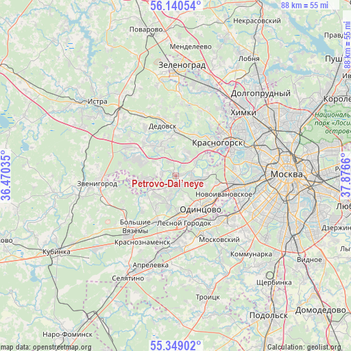
Petrovo-Dal’neye GPS coordinates[2]
55° 44' 48.444" North, 37° 10' 24.492" East
| Map corner | latitude | longitude |
|---|---|---|
| Upper-left | 56.14054°, | 36.47035° |
| Center: | 55.74679°, | 37.17347° |
| Lower-right: | 55.34902°, | 37.8766° |
| Map W x H: | 88×88 km | = 54.7×54.7mi |
| max Lat: | 73.50819° ⇑37.3% North |
| Petrovo-Dal’neye: | 55.74679° |
| min Lat: | ⇓62.7% South 41.28413° |
| min Long | Petrovo-Dal’n | max Long |
| -179.12198° | 37.17347° | 179.35046° |
| W 15.9%⇐ | ⇒84.1% E |
Elevation
Elevation of Petrovo-Dal’neye is 141 m = 463 ft, and this is 61.6 m = 202 ft below average elevation for this country.
| Max E: |
2518 m = 8261 ft | 51.6% |
| Avg. | 202.6 m = 665 ft | |
| Petrovo-Dal’neye | 141 m = 463 ft | |
Min E: |
-28 m = -92 ft | 48.4% |
See also: Russia elevation on elevation.city.
Geographical zone
Petrovo-Dal’neye is located in North temperate zone (between Tropic of Cancer and the Arctic Circle). Distance of this North polar circle is 1202.7 km =747.3 mi to North.| Distance of | km | miles | from Petrovo-Dal’neye |
|---|---|---|---|
| North Pole | 3808.6 | 2366.6 | to North |
| Arctic Circle | 1202.7 | 747.3 | to North |
| Tropic Cancer | 3592.5 | 2232.3 | to South |
| Equator | 6198.5 | 3851.6 | to South |


Nearby cities:
15 places around Petrovo-Dal’neye: (largest is in red/bold)
• Arkhangel’skoye
9.1 km =5.7 mi,  59°
59°
• Barvikha
6.6 km =4.1 mi,  94°
94°
• Dmitrovskoye
3.3 km =2.1 mi,  285°
285°
• Gorki Vtoryye
2.4 km =1.5 mi,  194°
194°
• Lesnoy Gorodok
12.2 km =7.6 mi,  169°
169°
• Nakhabino
11.3 km =7 mi,  1°
1°
• Nazar'yevo
11.6 km =7.2 mi,  225°
225°
• Nemchinovka
12 km =7.5 mi,  102°
102°
• Nikolina Gora
8.2 km =5.1 mi,  260°
260°
• Odintsovo
10.1 km =6.3 mi,  139°
139°
• Opalikha
10.1 km =6.3 mi,  29°
29°
• Pavlovskaya Sloboda
9.5 km =5.9 mi,  323°
323°
• Rublëvo
12.1 km =7.5 mi,  69°
69°
• Vniissok
10.3 km =6.4 mi, 166°
• Zhavoronki
11.7 km =7.3 mi,  202°
202°
Sources, notices
• [Note1] Compared only with cities in Russia existing in our database
• [Src1] Map data: © OpenStreetMap contributors (CC-BY-SA)
• [Src2] Other city data from geonames.org with taken over terms of usage.
• [Src3] Geographical zone / Annual Mean Temperature by Robert A. Rohde @ Wikipedia
