Vinogradovo geodata
Vinogradovo (Moscow Oblast) is a populated place; located in Russia in Europe/Moscow (GMT+3) time zone. With population of 9,600 people, there are 1568 cities with bigger population in this country. Compared to other cities in Russia, 76.6% of cities are located further ↓South; 81.3% of cities are located further →East and 55.1% of cities have higher elevation than Vinogradovo. Note1


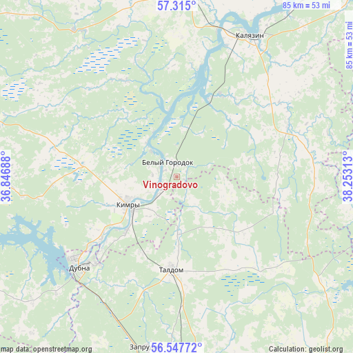
Vinogradovo GPS coordinates[2]
56° 55' 59.988" North, 37° 33' 0" East
| Map corner | latitude | longitude |
|---|---|---|
| Upper-left | 57.315°, | 36.84688° |
| Center: | 56.93333°, | 37.55° |
| Lower-right: | 56.54772°, | 38.25313° |
| Map W x H: | 85.3×85.3 km | = 53×53mi |
| max Lat: | 73.50819° ⇑23.4% North |
| Vinogradovo: | 56.93333° |
| min Lat: | ⇓76.6% South 41.28413° |
| min Long | Vinogradovo | max Long |
| -179.12198° | 37.55° | 179.35046° |
| W 18.7%⇐ | ⇒81.3% E |
Elevation
Elevation of Vinogradovo is 134 m = 440 ft, and this is 68.6 m = 225 ft below average elevation for this country.
| Max E: |
2518 m = 8261 ft | 55.1% |
| Avg. | 202.6 m = 665 ft | |
| Vinogradovo | 134 m = 440 ft | |
Min E: |
-28 m = -92 ft | 44.9% |
See also: Russia elevation on elevation.city.
Geographical zone
Vinogradovo is located in North temperate zone (between Tropic of Cancer and the Arctic Circle). Distance of this North polar circle is 1070.8 km =665.4 mi to North.| Distance of | km | miles | from Vinogradovo |
|---|---|---|---|
| North Pole | 3676.7 | 2284.6 | to North |
| Arctic Circle | 1070.8 | 665.4 | to North |
| Tropic Cancer | 3724.5 | 2314.3 | to South |
| Equator | 6330.4 | 3933.5 | to South |


Nearby cities:
15 places around Vinogradovo: (largest is in red/bold)
• Belyy Gorodok
4.2 km =2.6 mi,  327°
327°
• Dubna
32.2 km =20 mi,  226°
226°
• Il’inskoye
22.5 km =14 mi,  279°
279°
• Kalyazin
38.5 km =23.9 mi,  27°
27°
• Kimry
14.2 km =8.8 mi,  238°
238°
• Kvashenki
14.8 km =9.2 mi,  180°
180°
• Leont’yevskoye
44.9 km =27.9 mi,  38°
38°
• Nerl’
29.6 km =18.4 mi,  64°
64°
• Novo-Nikol’skoye
40.8 km =25.4 mi, 181°
• Pavlovichi
41.8 km =26 mi,  167°
167°
• Severnyy
23.1 km =14.4 mi,  164°
164°
• Taldom
22.3 km =13.9 mi, 182°
• Verbilki
44.6 km =27.7 mi, 176°
• Yurkino
22.4 km =13.9 mi, 172°
• Zaprudnya
41.4 km =25.7 mi,  189°
189°
Sources, notices
• [Note1] Compared only with cities in Russia existing in our database
• [Src1] Map data: © OpenStreetMap contributors (CC-BY-SA)
• [Src2] Other city data from geonames.org with taken over terms of usage.
• [Src3] Geographical zone / Annual Mean Temperature by Robert A. Rohde @ Wikipedia
