Verkhnetulomskiy geodata
Verkhnetulomskiy (Murmansk) is a populated place; located in Russia in Europe/Moscow (GMT+3) time zone. With population of 1,889 people, there are 4224 cities with bigger population in this country. Compared to other cities in Russia, 99.2% of cities are located further ↓South; 93.7% of cities are located further →East and 90.7% of cities have higher elevation than Verkhnetulomskiy. Note1


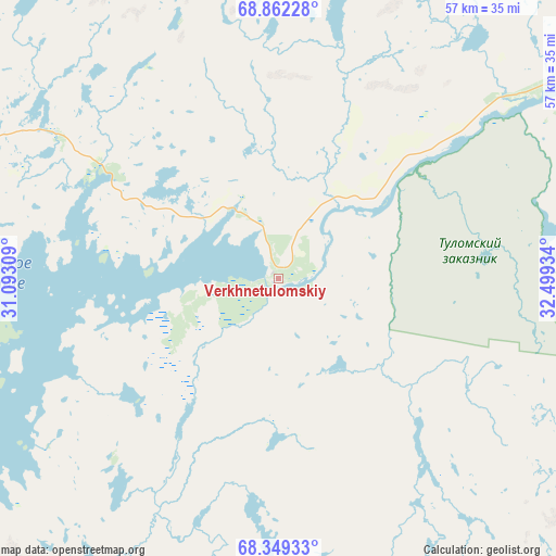
Verkhnetulomskiy GPS coordinates[2]
68° 36' 26.172" North, 31° 47' 46.356" East
| Map corner | latitude | longitude |
|---|---|---|
| Upper-left | 68.86228°, | 31.09309° |
| Center: | 68.60727°, | 31.79621° |
| Lower-right: | 68.34933°, | 32.49934° |
| Map W x H: | 57×57 km | = 35.4×35.4mi |
| max Lat: | 73.50819° ⇑0.8% North |
| Verkhnetulomskiy: | 68.60727° |
| min Lat: | ⇓99.2% South 41.28413° |
| min Long | Verkhnetulomski | max Long |
| -179.12198° | 31.79621° | 179.35046° |
| W 6.3%⇐ | ⇒93.7% E |
Elevation
Elevation of Verkhnetulomskiy is 26 m = 85 ft, and this is 176.6 m = 579 ft below average elevation for this country.
| Max E: |
2518 m = 8261 ft | 90.7% |
| Avg. | 202.6 m = 665 ft | |
| Verkhnetulomskiy | 26 m = 85 ft | |
Min E: |
-28 m = -92 ft | 9.3% |
See also: Russia elevation on elevation.city.
Geographical zone
Verkhnetulomskiy is located in North Frigid zone (between North Pole and Arctic Circle). Distance of this North polar circle is 227.2 km =141.2 mi to South.| Distance of | km | miles | from Verkhnetulomskiy |
|---|---|---|---|
| North Pole | 2378.6 | 1478 | to North |
| Arctic Circle | 227.2 | 141.2 | to South |
| Tropic Cancer | 5022.5 | 3120.8 | to South |
| Equator | 7628.4 | 4740.1 | to South |


Nearby cities:
15 places around Verkhnetulomskiy: (largest is in red/bold)
• Abram Mys
64.2 km =39.9 mi,  50°
50°
• Kola
57.9 km =36 mi,  58°
58°
• Molochnyy
56.5 km =35.1 mi, 60°
• Monchegorsk
86.5 km =53.7 mi,  149°
149°
• Murmansk
66.5 km =41.3 mi, 51°
• Murmashi
47.1 km =29.3 mi, 60°
• Olenegorsk
78.9 km =49 mi,  130°
130°
• Roslyakovo
74.3 km =46.2 mi, 49°
• Safonovo
78.5 km =48.8 mi, 50°
• Severomorsk
82.8 km =51.4 mi, 51°
• Severomorsk-3
83.4 km =51.8 mi,  68°
68°
• Shonguy
56.9 km =35.4 mi, 73°
• Snezhnogorsk
87.4 km =54.3 mi,  41°
41°
• Vidyayevo
58 km =36 mi, 58°
• Vysokiy
84.7 km =52.6 mi, 128°
Sources, notices
• [Note1] Compared only with cities in Russia existing in our database
• [Src1] Map data: © OpenStreetMap contributors (CC-BY-SA)
• [Src2] Other city data from geonames.org with taken over terms of usage.
• [Src3] Geographical zone / Annual Mean Temperature by Robert A. Rohde @ Wikipedia
