Tolmachevo geodata
Tolmachevo (Leningradskaya Oblast') is a populated place; located in Russia in Europe/Moscow (GMT+3) time zone. With population of 3,361 people, there are 3492 cities with bigger population in this country. Compared to other cities in Russia, 86.2% of cities are located further ↓South; 97.3% of cities are located further →East and 82.2% of cities have higher elevation than Tolmachevo. Note1


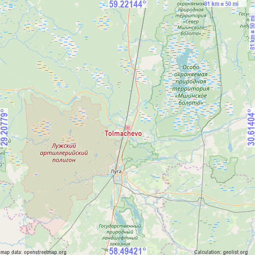
Tolmachevo GPS coordinates[2]
58° 51' 35.028" North, 29° 54' 39.276" East
| Map corner | latitude | longitude |
|---|---|---|
| Upper-left | 59.22144°, | 29.20779° |
| Center: | 58.85973°, | 29.91091° |
| Lower-right: | 58.49421°, | 30.61404° |
| Map W x H: | 80.9×80.9 km | = 50.3×50.3mi |
| max Lat: | 73.50819° ⇑13.8% North |
| Tolmachevo: | 58.85973° |
| min Lat: | ⇓86.2% South 41.28413° |
| min Long | Tolmachevo | max Long |
| -179.12198° | 29.91091° | 179.35046° |
| W 2.7%⇐ | ⇒97.3% E |
Elevation
Elevation of Tolmachevo is 62 m = 203 ft, and this is 140.6 m = 461 ft below average elevation for this country.
| Max E: |
2518 m = 8261 ft | 82.2% |
| Avg. | 202.6 m = 665 ft | |
| Tolmachevo | 62 m = 203 ft | |
Min E: |
-28 m = -92 ft | 17.8% |
See also: Russia elevation on elevation.city.
Geographical zone
Tolmachevo is located in North temperate zone (between Tropic of Cancer and the Arctic Circle). Distance of this North polar circle is 856.6 km =532.3 mi to North.| Distance of | km | miles | from Tolmachevo |
|---|---|---|---|
| North Pole | 3462.5 | 2151.5 | to North |
| Arctic Circle | 856.6 | 532.3 | to North |
| Tropic Cancer | 3938.7 | 2447.4 | to South |
| Equator | 6544.6 | 4066.6 | to South |


Nearby cities:
15 places around Tolmachevo: (largest is in red/bold)
• Batetskiy
32.8 km =20.4 mi,  136°
136°
• Druzhnaya Gorka
48.4 km =30.1 mi,  14°
14°
• Kikerino
69.2 km =43 mi,  346°
346°
• Kobrinskoye
63.7 km =39.6 mi, 10°
• Luga
14.1 km =8.8 mi,  195°
195°
• Mariyenburg
79.6 km =49.5 mi, 6°
• Mshinskaya
17.4 km =10.8 mi, 6°
• Plyussa
57.2 km =35.5 mi,  213°
213°
• Rozhdestveno
51 km =31.7 mi,  2°
2°
• Siverskiy
55.8 km =34.7 mi, 9°
• Utorgosh
67.3 km =41.8 mi,  162°
162°
• Volosovo
69.4 km =43.1 mi,  339°
339°
• Voyskovitsy
74.8 km =46.5 mi, 1°
• Vyritsa
65.8 km =40.9 mi,  22°
22°
• Yelizavetino
70.7 km =43.9 mi, 354°
Sources, notices
• [Note1] Compared only with cities in Russia existing in our database
• [Src1] Map data: © OpenStreetMap contributors (CC-BY-SA)
• [Src2] Other city data from geonames.org with taken over terms of usage.
• [Src3] Geographical zone / Annual Mean Temperature by Robert A. Rohde @ Wikipedia
