Suvorovskaya geodata
Suvorovskaya (Stavropol’ Kray) is a populated place; located in Russia in Europe/Moscow (GMT+3) time zone. With population of 17,261 people, there are 987 cities with bigger population in this country. Compared to other cities in Russia, 90.9% of cities are located further ↑North; 58% of cities are located further →East and 90.2% of cities have lower elevation than Suvorovskaya. Note1


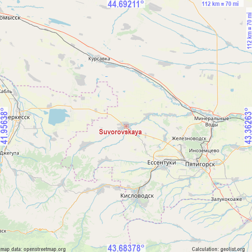
Suvorovskaya GPS coordinates[2]
44° 11' 24.36" North, 42° 39' 34.2" East
| Map corner | latitude | longitude |
|---|---|---|
| Upper-left | 44.69211°, | 41.95638° |
| Center: | 44.1901°, | 42.6595° |
| Lower-right: | 43.68378°, | 43.36263° |
| Map W x H: | 112.1×112.1 km | = 69.7×69.7mi |
| max Lat: | 73.50819° ⇑90.9% North |
| Suvorovskaya: | 44.1901° |
| min Lat: | ⇓9.1% South 41.28413° |
| min Long | Suvorovskaya | max Long |
| -179.12198° | 42.6595° | 179.35046° |
| W 42%⇐ | ⇒58% E |
Elevation
Elevation of Suvorovskaya is 456 m = 1496 ft, and this is 253.4 m = 831 ft above average elevation for this country.
| Max E: |
2518 m = 8261 ft | 9.8% |
| Suvorovskaya | 456 m 1496 ft | |
| Avg. | 202.6 m = 665 ft | |
Min E: |
-28 m = -92 ft | 90.2% |
See also: Russia elevation on elevation.city.
Geographical zone
Suvorovskaya is located in North temperate zone (between Tropic of Cancer and the Arctic Circle). Distance of this Northern Tropic circle is 2307.6 km =1433.9 mi to South.| Distance of | km | miles | from Suvorovskaya |
|---|---|---|---|
| North Pole | 5093.6 | 3165 | to North |
| Arctic Circle | 2487.7 | 1545.8 | to North |
| Tropic Cancer | 2307.6 | 1433.9 | to South |
| Equator | 4913.5 | 3053.1 | to South |


Nearby cities:
15 places around Suvorovskaya: (largest is in red/bold)
• Bekeshevskaya
20.4 km =12.7 mi,  245°
245°
• Borgustanskaya
18.3 km =11.4 mi,  214°
214°
• Grazhdanskoye
9.8 km =6.1 mi,  63°
63°
• Kangly
30.4 km =18.9 mi,  76°
76°
• Krasnyy Kurgan
27.8 km =17.3 mi,  188°
188°
• Lermontov
26.7 km =16.6 mi,  110°
110°
• Nezhinskiy
29.2 km =18.1 mi,  175°
175°
• Novoblagodarnoye
18 km =11.2 mi, 106°
• Soluno-Dmitriyevskoye
24.7 km =15.3 mi,  11°
11°
• Udarnyy
21.5 km =13.4 mi,  325°
325°
• Vinsady
27.3 km =17 mi,  116°
116°
• Yasnaya Polyana
20.1 km =12.5 mi,  157°
157°
• Yessentuki
22.8 km =14.2 mi,  135°
135°
• Yessentukskaya
24.9 km =15.5 mi,  134°
134°
• Zheleznovodsk
29.3 km =18.2 mi,  101°
101°
Sources, notices
• [Note1] Compared only with cities in Russia existing in our database
• [Src1] Map data: © OpenStreetMap contributors (CC-BY-SA)
• [Src2] Other city data from geonames.org with taken over terms of usage.
• [Src3] Geographical zone / Annual Mean Temperature by Robert A. Rohde @ Wikipedia
