Grazhdanskoye geodata
Grazhdanskoye (Stavropol’ Kray) is a populated place; located in Russia in Europe/Moscow (GMT+3) time zone. With population of 3,097 people, there are 3693 cities with bigger population in this country. Compared to other cities in Russia, 90.6% of cities are located further ↑North; 57.5% of cities are located further →East and 87.9% of cities have lower elevation than Grazhdanskoye. Note1


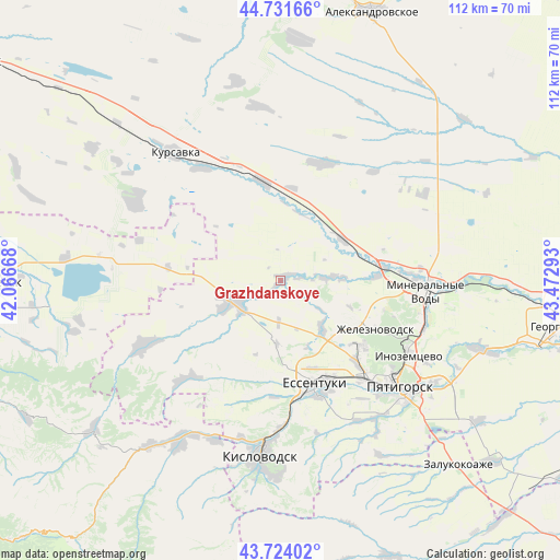
Grazhdanskoye GPS coordinates[2]
44° 13' 48" North, 42° 46' 11.28" East
| Map corner | latitude | longitude |
|---|---|---|
| Upper-left | 44.73166°, | 42.06668° |
| Center: | 44.23°, | 42.7698° |
| Lower-right: | 43.72402°, | 43.47293° |
| Map W x H: | 112×112 km | = 69.6×69.6mi |
| max Lat: | 73.50819° ⇑90.6% North |
| Grazhdanskoye: | 44.23° |
| min Lat: | ⇓9.4% South 41.28413° |
| min Long | Grazhdanskoye | max Long |
| -179.12198° | 42.7698° | 179.35046° |
| W 42.5%⇐ | ⇒57.5% E |
Elevation
Elevation of Grazhdanskoye is 395 m = 1296 ft, and this is 192.4 m = 631 ft above average elevation for this country.
| Max E: |
2518 m = 8261 ft | 12.1% |
| Grazhdanskoye | 395 m 1296 ft | |
| Avg. | 202.6 m = 665 ft | |
Min E: |
-28 m = -92 ft | 87.9% |
See also: Russia elevation on elevation.city.
Geographical zone
Grazhdanskoye is located in North temperate zone (between Tropic of Cancer and the Arctic Circle). Distance of this Northern Tropic circle is 2312 km =1436.6 mi to South.| Distance of | km | miles | from Grazhdanskoye |
|---|---|---|---|
| North Pole | 5089.1 | 3162.2 | to North |
| Arctic Circle | 2483.3 | 1543.1 | to North |
| Tropic Cancer | 2312 | 1436.6 | to South |
| Equator | 4917.9 | 3055.8 | to South |


Nearby cities:
15 places around Grazhdanskoye: (largest is in red/bold)
• Andzhiyevskiy
25.2 km =15.7 mi,  87°
87°
• Borgustanskaya
27.4 km =17 mi,  224°
224°
• Kangly
21 km =13 mi,  82°
82°
• Lermontov
21.2 km =13.2 mi,  130°
130°
• Nagutskoye
25 km =15.5 mi,  19°
19°
• Novoblagodarnoye
12.8 km =8 mi,  138°
138°
• Novoterskiy
27.3 km =17 mi,  109°
109°
• Soluno-Dmitriyevskoye
20.1 km =12.5 mi,  349°
349°
• Suvorovskaya
9.8 km =6.1 mi,  243°
243°
• Udarnyy
24.9 km =15.5 mi,  302°
302°
• Vinsady
22.8 km =14.2 mi, 136°
• Yasnaya Polyana
23.1 km =14.4 mi,  183°
183°
• Yessentuki
21.9 km =13.6 mi,  160°
160°
• Yessentukskaya
23.7 km =14.7 mi, 157°
• Zheleznovodsk
22.3 km =13.9 mi,  116°
116°
Sources, notices
• [Note1] Compared only with cities in Russia existing in our database
• [Src1] Map data: © OpenStreetMap contributors (CC-BY-SA)
• [Src2] Other city data from geonames.org with taken over terms of usage.
• [Src3] Geographical zone / Annual Mean Temperature by Robert A. Rohde @ Wikipedia
