Strugi-Krasnyye geodata
Strugi-Krasnyye (Pskov Oblast) is a populated place; located in Russia in Europe/Moscow (GMT+3) time zone. With population of 8,518 people, there are 1715 cities with bigger population in this country. Compared to other cities in Russia, 83.7% of cities are located further ↓South; 98.1% of cities are located further →East and 58.6% of cities have higher elevation than Strugi-Krasnyye. Note1


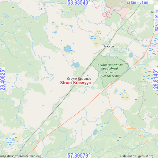
Strugi-Krasnyye GPS coordinates[2]
58° 16' 3.144" North, 29° 6' 40.932" East
| Map corner | latitude | longitude |
|---|---|---|
| Upper-left | 58.63543°, | 28.40825° |
| Center: | 58.26754°, | 29.11137° |
| Lower-right: | 57.89579°, | 29.8145° |
| Map W x H: | 82.2×82.2 km | = 51.1×51.1mi |
| max Lat: | 73.50819° ⇑16.3% North |
| Strugi-Krasnyye: | 58.26754° |
| min Lat: | ⇓83.7% South 41.28413° |
| min Long | Strugi-Krasnyye | max Long |
| -179.12198° | 29.11137° | 179.35046° |
| W 1.9%⇐ | ⇒98.1% E |
Elevation
Elevation of Strugi-Krasnyye is 127 m = 417 ft, and this is 75.6 m = 248 ft below average elevation for this country.
| Max E: |
2518 m = 8261 ft | 58.6% |
| Avg. | 202.6 m = 665 ft | |
| Strugi-Krasnyye | 127 m = 417 ft | |
Min E: |
-28 m = -92 ft | 41.4% |
See also: Russia elevation on elevation.city.
Geographical zone
Strugi-Krasnyye is located in North temperate zone (between Tropic of Cancer and the Arctic Circle). Distance of this North polar circle is 922.4 km =573.2 mi to North.| Distance of | km | miles | from Strugi-Krasnyye |
|---|---|---|---|
| North Pole | 3528.3 | 2192.4 | to North |
| Arctic Circle | 922.4 | 573.2 | to North |
| Tropic Cancer | 3872.8 | 2406.4 | to South |
| Equator | 6478.7 | 4025.7 | to South |


Nearby cities:
15 places around Strugi-Krasnyye: (largest is in red/bold)
• Batetskiy
81.1 km =50.4 mi,  58°
58°
• Dedovichi
93.8 km =58.3 mi,  148°
148°
• Dno
70 km =43.5 mi,  134°
134°
• Gdov
91.9 km =57.1 mi,  305°
305°
• Luga
67.4 km =41.9 mi,  39°
39°
• Mshinskaya
96 km =59.7 mi,  30°
30°
• Novyy Izborsk
86.9 km =54 mi,  230°
230°
• Plyussa
23.4 km =14.5 mi, 39°
• Porkhov
61.7 km =38.3 mi, 154°
• Pskov
67.5 km =41.9 mi,  221°
221°
• Serëdka
55.6 km =34.5 mi,  257°
257°
• Shimsk
93.9 km =58.3 mi,  93°
93°
• Sol’tsy
72.8 km =45.2 mi,  102°
102°
• Tolmachevo
80.5 km =50 mi, 35°
• Utorgosh
66.8 km =41.5 mi, 88°
Sources, notices
• [Note1] Compared only with cities in Russia existing in our database
• [Src1] Map data: © OpenStreetMap contributors (CC-BY-SA)
• [Src2] Other city data from geonames.org with taken over terms of usage.
• [Src3] Geographical zone / Annual Mean Temperature by Robert A. Rohde @ Wikipedia
