Rogachëvo geodata
Rogachëvo (Moscow Oblast) is a populated place; located in Russia in Europe/Moscow (GMT+3) time zone. With population of 3,379 people, there are 3475 cities with bigger population in this country. Compared to other cities in Russia, 72% of cities are located further ↓South; 84.2% of cities are located further →East and 57.7% of cities have higher elevation than Rogachëvo. Note1


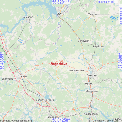
Rogachëvo GPS coordinates[2]
56° 25' 59.988" North, 37° 10' 0.012" East
| Map corner | latitude | longitude |
|---|---|---|
| Upper-left | 56.82011°, | 36.46355° |
| Center: | 56.43333°, | 37.16667° |
| Lower-right: | 56.04258°, | 37.8698° |
| Map W x H: | 86.5×86.5 km | = 53.7×53.7mi |
| max Lat: | 73.50819° ⇑28% North |
| Rogachëvo: | 56.43333° |
| min Lat: | ⇓72% South 41.28413° |
| min Long | Rogachëvo | max Long |
| -179.12198° | 37.16667° | 179.35046° |
| W 15.8%⇐ | ⇒84.2% E |
Elevation
Elevation of Rogachëvo is 129 m = 423 ft, and this is 73.6 m = 241 ft below average elevation for this country.
| Max E: |
2518 m = 8261 ft | 57.7% |
| Avg. | 202.6 m = 665 ft | |
| Rogachëvo | 129 m = 423 ft | |
Min E: |
-28 m = -92 ft | 42.3% |
See also: Russia elevation on elevation.city.
Geographical zone
Rogachëvo is located in North temperate zone (between Tropic of Cancer and the Arctic Circle). Distance of this North polar circle is 1126.4 km =699.9 mi to North.| Distance of | km | miles | from Rogachëvo |
|---|---|---|---|
| North Pole | 3732.3 | 2319.1 | to North |
| Arctic Circle | 1126.4 | 699.9 | to North |
| Tropic Cancer | 3668.9 | 2279.7 | to South |
| Equator | 6274.8 | 3899 | to South |


Nearby cities:
15 places around Rogachëvo: (largest is in red/bold)
• Avtopoligon
13.4 km =8.3 mi,  133°
133°
• Bunyatino
6.3 km =3.9 mi, 125°
• Dmitrov
23.9 km =14.9 mi,  114°
114°
• Gorshkovo
16.4 km =10.2 mi, 113°
• Melchevka
14.5 km =9 mi,  75°
75°
• Novo-Nikol’skoye
26.9 km =16.7 mi,  56°
56°
• Novoshchapovo
23.6 km =14.7 mi,  253°
253°
• Novosin’kovo
11.8 km =7.3 mi,  121°
121°
• Orevo
18.4 km =11.4 mi,  90°
90°
• Orud’yevo
22.5 km =14 mi, 90°
• Pod"yachevo
19.6 km =12.2 mi,  164°
164°
• Shevlyakovo
19.3 km =12 mi,  258°
258°
• Yakhroma
24.5 km =15.2 mi, 127°
• Zaprudnya
22.1 km =13.7 mi,  47°
47°
• Zhukovka
22.2 km =13.8 mi, 75°
Sources, notices
• [Note1] Compared only with cities in Russia existing in our database
• [Src1] Map data: © OpenStreetMap contributors (CC-BY-SA)
• [Src2] Other city data from geonames.org with taken over terms of usage.
• [Src3] Geographical zone / Annual Mean Temperature by Robert A. Rohde @ Wikipedia
