Raysemënovskoye geodata
Raysemënovskoye (Moscow Oblast) is a populated place; located in Russia in Europe/Moscow (GMT+3) time zone. With population of 876 people, there are 4716 cities with bigger population in this country. Compared to other cities in Russia, 53.3% of cities are located further ↓South; 83.2% of cities are located further →East and 54.9% of cities have lower elevation than Raysemënovskoye. Note1


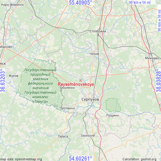
Raysemënovskoye GPS coordinates[2]
55° 0' 28.296" North, 37° 20' 6.54" East
| Map corner | latitude | longitude |
|---|---|---|
| Upper-left | 55.40905°, | 36.63203° |
| Center: | 55.00786°, | 37.33515° |
| Lower-right: | 54.60261°, | 38.03828° |
| Map W x H: | 89.7×89.7 km | = 55.7×55.7mi |
| max Lat: | 73.50819° ⇑46.7% North |
| Raysemënovskoye: | 55.00786° |
| min Lat: | ⇓53.3% South 41.28413° |
| min Long | Raysemënovskoy | max Long |
| -179.12198° | 37.33515° | 179.35046° |
| W 16.8%⇐ | ⇒83.2% E |
Elevation
Elevation of Raysemënovskoye is 156 m = 512 ft, and this is 46.6 m = 153 ft below average elevation for this country.
| Max E: |
2518 m = 8261 ft | 45.1% |
| Avg. | 202.6 m = 665 ft | |
| Raysemënovskoye | 156 m = 512 ft | |
Min E: |
-28 m = -92 ft | 54.9% |
See also: Russia elevation on elevation.city.
Geographical zone
Raysemënovskoye is located in North temperate zone (between Tropic of Cancer and the Arctic Circle). Distance of this North polar circle is 1284.9 km =798.4 mi to North.| Distance of | km | miles | from Raysemënovskoye |
|---|---|---|---|
| North Pole | 3890.8 | 2417.6 | to North |
| Arctic Circle | 1284.9 | 798.4 | to North |
| Tropic Cancer | 3510.4 | 2181.3 | to South |
| Equator | 6116.3 | 3800.5 | to South |


Nearby cities:
15 places around Raysemënovskoye: (largest is in red/bold)
• Chekhov
18 km =11.2 mi,  30°
30°
• Chepelëvo
22 km =13.7 mi, 27°
• Danki
18 km =11.2 mi,  123°
123°
• Kremenki
19.3 km =12 mi,  225°
225°
• Melikhovo
23.2 km =14.4 mi,  59°
59°
• Novyy Byt
18.6 km =11.6 mi,  72°
72°
• Obolensk
7.8 km =4.8 mi,  244°
244°
• Popovo
22.4 km =13.9 mi, 70°
• Proletarskiy
3.9 km =2.4 mi, 65°
• Protvino
17.3 km =10.7 mi,  206°
206°
• Pushchino
26.2 km =16.3 mi,  137°
137°
• Serpukhov
11.3 km =7 mi,  154°
154°
• Sharapova Okhota
9.7 km =6 mi, 69°
• Stolbovaya
28.7 km =17.8 mi,  20°
20°
• Vysokinichi
28 km =17.4 mi,  246°
246°
Sources, notices
• [Note1] Compared only with cities in Russia existing in our database
• [Src1] Map data: © OpenStreetMap contributors (CC-BY-SA)
• [Src2] Other city data from geonames.org with taken over terms of usage.
• [Src3] Geographical zone / Annual Mean Temperature by Robert A. Rohde @ Wikipedia
