Rayevskaya geodata
Rayevskaya (Krasnodarskiy) is a populated place; located in Russia in Europe/Moscow (GMT+3) time zone. With population of 8,518 people, there are 1715 cities with bigger population in this country. Compared to other cities in Russia, 88.1% of cities are located further ↑North; 81.1% of cities are located further →East and 59.2% of cities have higher elevation than Rayevskaya. Note1


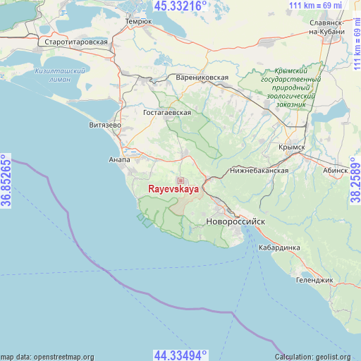
Rayevskaya GPS coordinates[2]
44° 50' 8.556" North, 37° 33' 20.772" East
| Map corner | latitude | longitude |
|---|---|---|
| Upper-left | 45.33216°, | 36.85265° |
| Center: | 44.83571°, | 37.55577° |
| Lower-right: | 44.33494°, | 38.2589° |
| Map W x H: | 110.9×110.9 km | = 68.9×68.9mi |
| max Lat: | 73.50819° ⇑88.1% North |
| Rayevskaya: | 44.83571° |
| min Lat: | ⇓11.9% South 41.28413° |
| min Long | Rayevskaya | max Long |
| -179.12198° | 37.55577° | 179.35046° |
| W 18.9%⇐ | ⇒81.1% E |
Elevation
Elevation of Rayevskaya is 126 m = 413 ft, and this is 76.6 m = 251 ft below average elevation for this country.
| Max E: |
2518 m = 8261 ft | 59.2% |
| Avg. | 202.6 m = 665 ft | |
| Rayevskaya | 126 m = 413 ft | |
Min E: |
-28 m = -92 ft | 40.8% |
See also: Russia elevation on elevation.city.
Geographical zone
Rayevskaya is located in North temperate zone (between Tropic of Cancer and the Arctic Circle). Distance of this Northern Tropic circle is 2379.3 km =1478.4 mi to South.| Distance of | km | miles | from Rayevskaya |
|---|---|---|---|
| North Pole | 5021.8 | 3120.4 | to North |
| Arctic Circle | 2415.9 | 1501.2 | to North |
| Tropic Cancer | 2379.3 | 1478.4 | to South |
| Equator | 4985.3 | 3097.7 | to South |


Nearby cities:
15 places around Rayevskaya: (largest is in red/bold)
• Abrau-Dyurso
15.5 km =9.6 mi,  166°
166°
• Anapa
19.3 km =12 mi,  288°
288°
• Anapskaya
15 km =9.3 mi,  296°
296°
• Gayduk
12.7 km =7.9 mi,  116°
116°
• Gostagayevskaya
21.2 km =13.2 mi,  349°
349°
• Kiyevskoye
34.5 km =21.4 mi,  49°
49°
• Myskhako
25.7 km =16 mi,  139°
139°
• Novorossiysk
20.8 km =12.9 mi,  126°
126°
• Sukko
11.3 km =7 mi,  249°
249°
• Tsibanobalka
23.2 km =14.4 mi,  313°
313°
• Varenikovskaya
32.4 km =20.1 mi,  12°
12°
• Verkhnebakanskiy
8.1 km =5 mi,  79°
79°
• Vinogradnyy
30.7 km =19.1 mi,  323°
323°
• Vityazevo
28.3 km =17.6 mi, 310°
• Yurovka
32.8 km =20.4 mi,  340°
340°
Sources, notices
• [Note1] Compared only with cities in Russia existing in our database
• [Src1] Map data: © OpenStreetMap contributors (CC-BY-SA)
• [Src2] Other city data from geonames.org with taken over terms of usage.
• [Src3] Geographical zone / Annual Mean Temperature by Robert A. Rohde @ Wikipedia
