Petropavlovskaya geodata
Petropavlovskaya (Chechnya) is a populated place; located in Russia in Europe/Moscow (GMT+3) time zone. With population of 3,686 people, there are 3282 cities with bigger population in this country. Compared to other cities in Russia, 94.7% of cities are located further ↑North; 52.4% of cities are located further ←West and 65.3% of cities have higher elevation than Petropavlovskaya. Note1


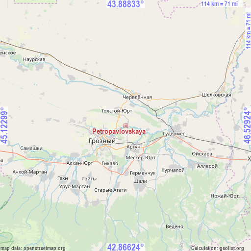
Petropavlovskaya GPS coordinates[2]
43° 22' 45.984" North, 45° 49' 33.996" East
| Map corner | latitude | longitude |
|---|---|---|
| Upper-left | 43.88833°, | 45.12299° |
| Center: | 43.37944°, | 45.82611° |
| Lower-right: | 42.86624°, | 46.52924° |
| Map W x H: | 113.6×113.6 km | = 70.6×70.6mi |
| max Lat: | 73.50819° ⇑94.7% North |
| Petropavlovskaya: | 43.37944° |
| min Lat: | ⇓5.3% South 41.28413° |
| min Long | Petropavlovskay | max Long |
| -179.12198° | 45.82611° | 179.35046° |
| W 52.4%⇐ | ⇒47.6% E |
Elevation
Elevation of Petropavlovskaya is 113 m = 371 ft, and this is 89.6 m = 294 ft below average elevation for this country.
| Max E: |
2518 m = 8261 ft | 65.3% |
| Avg. | 202.6 m = 665 ft | |
| Petropavlovskaya | 113 m = 371 ft | |
Min E: |
-28 m = -92 ft | 34.7% |
See also: Russia elevation on elevation.city.
Geographical zone
Petropavlovskaya is located in North temperate zone (between Tropic of Cancer and the Arctic Circle). Distance of this Northern Tropic circle is 2217.4 km =1377.8 mi to South.| Distance of | km | miles | from Petropavlovskaya |
|---|---|---|---|
| North Pole | 5183.7 | 3221 | to North |
| Arctic Circle | 2577.8 | 1601.8 | to North |
| Tropic Cancer | 2217.4 | 1377.8 | to South |
| Equator | 4823.3 | 2997.1 | to South |


Nearby cities:
15 places around Petropavlovskaya: (largest is in red/bold)
• Argun
10 km =6.2 mi,  156°
156°
• Belgatoy
21.1 km =13.1 mi,  178°
178°
• Chechen-Aul
20.2 km =12.6 mi,  188°
188°
• Dzhalka
14.7 km =9.1 mi,  117°
117°
• Germenchuk
22.9 km =14.2 mi, 160°
• Groznyy
13.4 km =8.3 mi,  235°
235°
• Gudermes
23.1 km =14.4 mi,  97°
97°
• Ilaskhan-Yurt
25 km =15.5 mi, 116°
• Khankala
10.3 km =6.4 mi,  213°
213°
• Mesker-Yurt
15.7 km =9.8 mi, 155°
• Pervomayskaya
24.6 km =15.3 mi,  276°
276°
• Prigorodnoye
15.1 km =9.4 mi,  201°
201°
• Staraya Sunzha
8.3 km =5.2 mi,  233°
233°
• Tolstoy-Yurt
8.3 km =5.2 mi,  332°
332°
• Tsotsin-Yurt
20.8 km =12.9 mi,  137°
137°
Sources, notices
• [Note1] Compared only with cities in Russia existing in our database
• [Src1] Map data: © OpenStreetMap contributors (CC-BY-SA)
• [Src2] Other city data from geonames.org with taken over terms of usage.
• [Src3] Geographical zone / Annual Mean Temperature by Robert A. Rohde @ Wikipedia
