Pavlovka geodata
Pavlovka (Ulyanovsk) is a populated place; located in Russia in Europe/Ulyanovsk (GMT+4) time zone. With population of 5,944 people, there are 2273 cities with bigger population in this country. Compared to other cities in Russia, 64.9% of cities are located further ↑North; 56.4% of cities are located further ←West and 62.9% of cities have lower elevation than Pavlovka. Note1


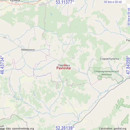
Pavlovka GPS coordinates[2]
52° 41' 22.776" North, 47° 8' 25.656" East
| Map corner | latitude | longitude |
|---|---|---|
| Upper-left | 53.11377°, | 46.43734° |
| Center: | 52.68966°, | 47.14046° |
| Lower-right: | 52.26139°, | 47.84359° |
| Map W x H: | 94.8×94.8 km | = 58.9×58.9mi |
| max Lat: | 73.50819° ⇑64.9% North |
| Pavlovka: | 52.68966° |
| min Lat: | ⇓35.1% South 41.28413° |
| min Long | Pavlovka | max Long |
| -179.12198° | 47.14046° | 179.35046° |
| W 56.4%⇐ | ⇒43.6% E |
Elevation
Elevation of Pavlovka is 176 m = 577 ft, and this is 26.6 m = 87 ft below average elevation for this country.
| Max E: |
2518 m = 8261 ft | 37.1% |
| Avg. | 202.6 m = 665 ft | |
| Pavlovka | 176 m = 577 ft | |
Min E: |
-28 m = -92 ft | 62.9% |
See also: Russia elevation on elevation.city.
Geographical zone
Pavlovka is located in North temperate zone (between Tropic of Cancer and the Arctic Circle). Distance of this North polar circle is 1542.6 km =958.5 mi to North.| Distance of | km | miles | from Pavlovka |
|---|---|---|---|
| North Pole | 4148.5 | 2577.8 | to North |
| Arctic Circle | 1542.6 | 958.5 | to North |
| Tropic Cancer | 3252.6 | 2021.1 | to South |
| Equator | 5858.5 | 3640.3 | to South |


Nearby cities:
15 places around Pavlovka: (largest is in red/bold)
• Baltay
42.5 km =26.4 mi,  234°
234°
• Cherkasskoye
29.4 km =18.3 mi,  170°
170°
• Kanadey
59.1 km =36.7 mi,  25°
25°
• Khvatovka
54.2 km =33.7 mi, 226°
• Kuznetsk
59.7 km =37.1 mi,  322°
322°
• Neverkino
28.9 km =18 mi,  291°
291°
• Nikolayevka
48.7 km =30.3 mi,  5°
5°
• Novospasskoye
65.3 km =40.6 mi,  38°
38°
• Poselki
65.2 km =40.5 mi, 319°
• Radishchevo
52.8 km =32.8 mi,  69°
69°
• Sennoy
61.1 km =38 mi,  191°
191°
• Shikhany
63.7 km =39.6 mi,  176°
176°
• Staraya Kulatka
32.4 km =20.1 mi,  82°
82°
• Svobodnyy
65.6 km =40.8 mi, 232°
• Zarechnyy
61.9 km =38.5 mi, 322°
Sources, notices
• [Note1] Compared only with cities in Russia existing in our database
• [Src1] Map data: © OpenStreetMap contributors (CC-BY-SA)
• [Src2] Other city data from geonames.org with taken over terms of usage.
• [Src3] Geographical zone / Annual Mean Temperature by Robert A. Rohde @ Wikipedia
