Novospasskoye geodata
Novospasskoye (Ulyanovsk) is a populated place; located in Russia in Europe/Ulyanovsk (GMT+4) time zone. With population of 10,941 people, there are 1383 cities with bigger population in this country. Compared to other cities in Russia, 61.8% of cities are located further ↑North; 58.2% of cities are located further ←West and 80% of cities have higher elevation than Novospasskoye. Note1


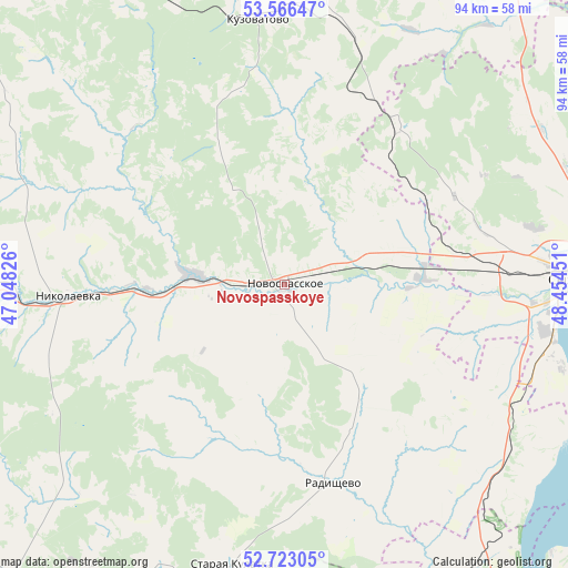
Novospasskoye GPS coordinates[2]
53° 8' 48.588" North, 47° 45' 4.968" East
| Map corner | latitude | longitude |
|---|---|---|
| Upper-left | 53.56647°, | 47.04826° |
| Center: | 53.14683°, | 47.75138° |
| Lower-right: | 52.72305°, | 48.45451° |
| Map W x H: | 93.8×93.8 km | = 58.3×58.3mi |
| max Lat: | 73.50819° ⇑61.8% North |
| Novospasskoye: | 53.14683° |
| min Lat: | ⇓38.2% South 41.28413° |
| min Long | Novospasskoye | max Long |
| -179.12198° | 47.75138° | 179.35046° |
| W 58.2%⇐ | ⇒41.8% E |
Elevation
Elevation of Novospasskoye is 71 m = 233 ft, and this is 131.6 m = 432 ft below average elevation for this country.
| Max E: |
2518 m = 8261 ft | 80% |
| Avg. | 202.6 m = 665 ft | |
| Novospasskoye | 71 m = 233 ft | |
Min E: |
-28 m = -92 ft | 20% |
See also: Russia elevation on elevation.city.
Geographical zone
Novospasskoye is located in North temperate zone (between Tropic of Cancer and the Arctic Circle). Distance of this North polar circle is 1491.8 km =927 mi to North.| Distance of | km | miles | from Novospasskoye |
|---|---|---|---|
| North Pole | 4097.7 | 2546.2 | to North |
| Arctic Circle | 1491.8 | 927 | to North |
| Tropic Cancer | 3303.5 | 2052.7 | to South |
| Equator | 5909.4 | 3671.9 | to South |


Nearby cities:
15 places around Novospasskoye: (largest is in red/bold)
• Balasheyka
27 km =16.8 mi,  55°
55°
• Barysh
70.7 km =43.9 mi,  323°
323°
• Imeni Vladimira Il’icha Lenina
69.1 km =42.9 mi,  312°
312°
• Kanadey
15.2 km =9.4 mi,  278°
278°
• Kuzovatovo
44.7 km =27.8 mi,  354°
354°
• Nikolayevka
36.6 km =22.7 mi,  266°
266°
• Oktyabr’sk
63.3 km =39.3 mi,  87°
87°
• Pavlovka
65.3 km =40.6 mi,  218°
218°
• Radishchevo
33.6 km =20.9 mi,  165°
165°
• Shigony
67.2 km =41.8 mi,  66°
66°
• Staraya Kulatka
47.4 km =29.5 mi,  190°
190°
• Starotimoshkino
65.3 km =40.6 mi, 347°
• Syzran’
47.8 km =29.7 mi, 88°
• Varlamovo
45 km =28 mi,  83°
83°
• Zhadovka
71.4 km =44.4 mi, 311°
Sources, notices
• [Note1] Compared only with cities in Russia existing in our database
• [Src1] Map data: © OpenStreetMap contributors (CC-BY-SA)
• [Src2] Other city data from geonames.org with taken over terms of usage.
• [Src3] Geographical zone / Annual Mean Temperature by Robert A. Rohde @ Wikipedia
