Myaksa geodata
Myaksa (Vologda) is a populated place; located in Russia in Europe/Moscow (GMT+3) time zone. With population of 1,143 people, there are 4554 cities with bigger population in this country. Compared to other cities in Russia, 86.2% of cities are located further ↓South; 75.9% of cities are located further →East and 55.1% of cities have higher elevation than Myaksa. Note1


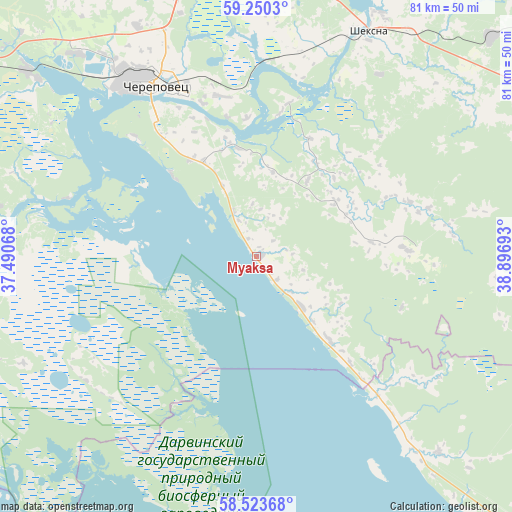
Myaksa GPS coordinates[2]
58° 53' 20.04" North, 38° 11' 37.68" East
| Map corner | latitude | longitude |
|---|---|---|
| Upper-left | 59.2503°, | 37.49068° |
| Center: | 58.8889°, | 38.1938° |
| Lower-right: | 58.52368°, | 38.89693° |
| Map W x H: | 80.8×80.8 km | = 50.2×50.2mi |
| max Lat: | 73.50819° ⇑13.8% North |
| Myaksa: | 58.8889° |
| min Lat: | ⇓86.2% South 41.28413° |
| min Long | Myaksa | max Long |
| -179.12198° | 38.1938° | 179.35046° |
| W 24.1%⇐ | ⇒75.9% E |
Elevation
Elevation of Myaksa is 134 m = 440 ft, and this is 68.6 m = 225 ft below average elevation for this country.
| Max E: |
2518 m = 8261 ft | 55.1% |
| Avg. | 202.6 m = 665 ft | |
| Myaksa | 134 m = 440 ft | |
Min E: |
-28 m = -92 ft | 44.9% |
See also: Russia elevation on elevation.city.
Geographical zone
Myaksa is located in North temperate zone (between Tropic of Cancer and the Arctic Circle). Distance of this North polar circle is 853.3 km =530.2 mi to North.| Distance of | km | miles | from Myaksa |
|---|---|---|---|
| North Pole | 3459.2 | 2149.4 | to North |
| Arctic Circle | 853.3 | 530.2 | to North |
| Tropic Cancer | 3941.9 | 2449.4 | to South |
| Equator | 6547.8 | 4068.6 | to South |


Nearby cities:
15 places around Myaksa: (largest is in red/bold)
• Borok
91.6 km =56.9 mi,  178°
178°
• Breytovo
68.3 km =42.4 mi,  196°
196°
• Chebsara
50.4 km =31.3 mi,  46°
46°
• Cherepovets
32 km =19.9 mi,  328°
328°
• Imeni Zhelyabova
92 km =57.2 mi,  274°
274°
• Kaduy
69 km =42.9 mi,  300°
300°
• Khokhlovo
53.9 km =33.5 mi, 302°
• Molochnoye
95.9 km =59.6 mi,  62°
62°
• Nelazskoye
46 km =28.6 mi,  316°
316°
• Poshekhon’ye
69.5 km =43.2 mi,  128°
128°
• Sheksna
40 km =24.9 mi,  26°
26°
• Suda
46.7 km =29 mi,  308°
308°
• Sudoverf’
89.7 km =55.7 mi,  163°
163°
• Tonshalovo
36.8 km =22.9 mi,  337°
337°
• Ves’yegonsk
59.3 km =36.8 mi,  245°
245°
Sources, notices
• [Note1] Compared only with cities in Russia existing in our database
• [Src1] Map data: © OpenStreetMap contributors (CC-BY-SA)
• [Src2] Other city data from geonames.org with taken over terms of usage.
• [Src3] Geographical zone / Annual Mean Temperature by Robert A. Rohde @ Wikipedia
