Breytovo geodata
Breytovo (Jaroslavl) is a populated place; located in Russia in Europe/Moscow (GMT+3) time zone. With population of 3,632 people, there are 3314 cities with bigger population in this country. Compared to other cities in Russia, 83.9% of cities are located further ↓South; 78.3% of cities are located further →East and 67.2% of cities have higher elevation than Breytovo. Note1


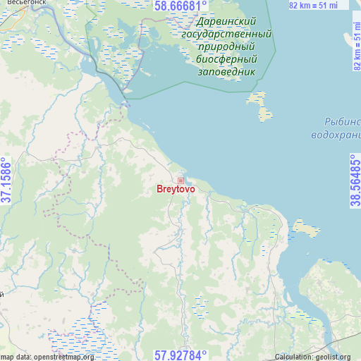
Breytovo GPS coordinates[2]
58° 17' 57.3" North, 37° 51' 42.192" East
| Map corner | latitude | longitude |
|---|---|---|
| Upper-left | 58.66681°, | 37.1586° |
| Center: | 58.29925°, | 37.86172° |
| Lower-right: | 57.92784°, | 38.56485° |
| Map W x H: | 82.2×82.2 km | = 51.1×51.1mi |
| max Lat: | 73.50819° ⇑16.1% North |
| Breytovo: | 58.29925° |
| min Lat: | ⇓83.9% South 41.28413° |
| min Long | Breytovo | max Long |
| -179.12198° | 37.86172° | 179.35046° |
| W 21.7%⇐ | ⇒78.3% E |
Elevation
Elevation of Breytovo is 109 m = 358 ft, and this is 93.6 m = 307 ft below average elevation for this country.
| Max E: |
2518 m = 8261 ft | 67.2% |
| Avg. | 202.6 m = 665 ft | |
| Breytovo | 109 m = 358 ft | |
Min E: |
-28 m = -92 ft | 32.8% |
See also: Russia elevation on elevation.city.
Geographical zone
Breytovo is located in North temperate zone (between Tropic of Cancer and the Arctic Circle). Distance of this North polar circle is 918.9 km =571 mi to North.| Distance of | km | miles | from Breytovo |
|---|---|---|---|
| North Pole | 3524.8 | 2190.2 | to North |
| Arctic Circle | 918.9 | 571 | to North |
| Tropic Cancer | 3876.3 | 2408.6 | to South |
| Equator | 6482.3 | 4027.9 | to South |


Nearby cities:
15 places around Breytovo: (largest is in red/bold)
• Borok
34 km =21.1 mi,  139°
139°
• Krasnyy Kholm
50.9 km =31.6 mi,  238°
238°
• Molokovo
66 km =41 mi,  257°
257°
• Myaksa
68.3 km =42.4 mi,  16°
16°
• Myshkin
66.5 km =41.3 mi,  148°
148°
• Novyy Nekouz
45.7 km =28.4 mi,  164°
164°
• Pesochnoye
83.8 km =52.1 mi,  112°
112°
• Poshekhon’ye
77.5 km =48.2 mi,  73°
73°
• Rybinsk
64.1 km =39.8 mi,  116°
116°
• Sandovo
86.3 km =53.6 mi,  281°
281°
• Shestikhino
46.1 km =28.6 mi, 151°
• Sonkovo
71.3 km =44.3 mi,  215°
215°
• Sudoverf’
50 km =31.1 mi, 113°
• Ves’yegonsk
53.5 km =33.2 mi,  319°
319°
• Volga
49.5 km =30.8 mi, 141°
Sources, notices
• [Note1] Compared only with cities in Russia existing in our database
• [Src1] Map data: © OpenStreetMap contributors (CC-BY-SA)
• [Src2] Other city data from geonames.org with taken over terms of usage.
• [Src3] Geographical zone / Annual Mean Temperature by Robert A. Rohde @ Wikipedia
