Lyubytino geodata
Lyubytino (Novgorod Oblast) is a populated place; located in Russia in Europe/Moscow (GMT+3) time zone. With population of 3,225 people, there are 3589 cities with bigger population in this country. Compared to other cities in Russia, 86% of cities are located further ↓South; 91.4% of cities are located further →East and 80% of cities have higher elevation than Lyubytino. Note1


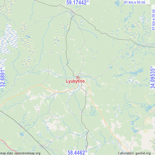
Lyubytino GPS coordinates[2]
58° 48' 43.992" North, 33° 23' 31.992" East
| Map corner | latitude | longitude |
|---|---|---|
| Upper-left | 59.17442°, | 32.6891° |
| Center: | 58.81222°, | 33.39222° |
| Lower-right: | 58.4462°, | 34.09535° |
| Map W x H: | 81×81 km | = 50.3×50.3mi |
| max Lat: | 73.50819° ⇑14% North |
| Lyubytino: | 58.81222° |
| min Lat: | ⇓86% South 41.28413° |
| min Long | Lyubytino | max Long |
| -179.12198° | 33.39222° | 179.35046° |
| W 8.6%⇐ | ⇒91.4% E |
Elevation
Elevation of Lyubytino is 71 m = 233 ft, and this is 131.6 m = 432 ft below average elevation for this country.
| Max E: |
2518 m = 8261 ft | 80% |
| Avg. | 202.6 m = 665 ft | |
| Lyubytino | 71 m = 233 ft | |
Min E: |
-28 m = -92 ft | 20% |
See also: Russia elevation on elevation.city.
Geographical zone
Lyubytino is located in North temperate zone (between Tropic of Cancer and the Arctic Circle). Distance of this North polar circle is 861.9 km =535.6 mi to North.| Distance of | km | miles | from Lyubytino |
|---|---|---|---|
| North Pole | 3467.8 | 2154.8 | to North |
| Arctic Circle | 861.9 | 535.6 | to North |
| Tropic Cancer | 3933.4 | 2444.1 | to South |
| Equator | 6539.3 | 4063.3 | to South |


Nearby cities:
15 places around Lyubytino: (largest is in red/bold)
• Boksitogorsk
78.1 km =48.5 mi,  19°
19°
• Borovichi
56.1 km =34.9 mi,  147°
147°
• Budogoshch’
74.2 km =46.1 mi,  314°
314°
• Kholm
59.3 km =36.8 mi,  328°
328°
• Khvoynaya
66.3 km =41.2 mi,  81°
81°
• Konchanskoye-Suvorovskoye
42.7 km =26.5 mi,  113°
113°
• Kulotino
40.3 km =25 mi,  180°
180°
• Lykoshino
80.8 km =50.2 mi,  166°
166°
• Malaya Vishera
67.4 km =41.9 mi,  273°
273°
• Moshenskoye
77 km =47.8 mi,  115°
115°
• Nebolchi
34.8 km =21.6 mi,  355°
355°
• Okulovka
46.1 km =28.6 mi,  187°
187°
• Opechenskiy Posad
73.1 km =45.4 mi,  144°
144°
• Uglovka
64.1 km =39.8 mi, 173°
• Zarubino
9.8 km =6.1 mi, 150°
Sources, notices
• [Note1] Compared only with cities in Russia existing in our database
• [Src1] Map data: © OpenStreetMap contributors (CC-BY-SA)
• [Src2] Other city data from geonames.org with taken over terms of usage.
• [Src3] Geographical zone / Annual Mean Temperature by Robert A. Rohde @ Wikipedia
