Khvoynaya geodata
Khvoynaya (Novgorod Oblast) is a populated place; located in Russia in Europe/Moscow (GMT+3) time zone. With population of 6,637 people, there are 2091 cities with bigger population in this country. Compared to other cities in Russia, 86.3% of cities are located further ↓South; 89.6% of cities are located further →East and 58.2% of cities have lower elevation than Khvoynaya. Note1


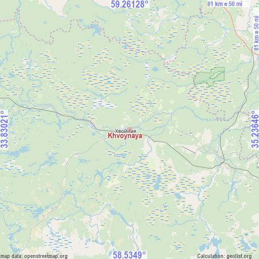
Khvoynaya GPS coordinates[2]
58° 54' 0" North, 34° 31' 59.988" East
| Map corner | latitude | longitude |
|---|---|---|
| Upper-left | 59.26128°, | 33.83021° |
| Center: | 58.9°, | 34.53333° |
| Lower-right: | 58.5349°, | 35.23646° |
| Map W x H: | 80.8×80.8 km | = 50.2×50.2mi |
| max Lat: | 73.50819° ⇑13.7% North |
| Khvoynaya: | 58.9° |
| min Lat: | ⇓86.3% South 41.28413° |
| min Long | Khvoynaya | max Long |
| -179.12198° | 34.53333° | 179.35046° |
| W 10.4%⇐ | ⇒89.6% E |
Elevation
Elevation of Khvoynaya is 164 m = 538 ft, and this is 38.6 m = 127 ft below average elevation for this country.
| Max E: |
2518 m = 8261 ft | 41.8% |
| Avg. | 202.6 m = 665 ft | |
| Khvoynaya | 164 m = 538 ft | |
Min E: |
-28 m = -92 ft | 58.2% |
See also: Russia elevation on elevation.city.
Geographical zone
Khvoynaya is located in North temperate zone (between Tropic of Cancer and the Arctic Circle). Distance of this North polar circle is 852.1 km =529.5 mi to North.| Distance of | km | miles | from Khvoynaya |
|---|---|---|---|
| North Pole | 3458 | 2148.7 | to North |
| Arctic Circle | 852.1 | 529.5 | to North |
| Tropic Cancer | 3943.1 | 2450.1 | to South |
| Equator | 6549.1 | 4069.4 | to South |


Nearby cities:
15 places around Khvoynaya: (largest is in red/bold)
• Boksitogorsk
74.8 km =46.5 mi,  328°
328°
• Borovichi
67.2 km =41.8 mi,  212°
212°
• Chagoda
54.1 km =33.6 mi,  57°
57°
• Konchanskoye-Suvorovskoye
38.1 km =23.7 mi,  224°
224°
• Kulotino
83.2 km =51.7 mi,  233°
233°
• Lesnoye
89.1 km =55.4 mi,  140°
140°
• Lyubytino
66.3 km =41.2 mi,  261°
261°
• Moshenskoye
43.5 km =27 mi,  175°
175°
• Nebolchi
72.4 km =45 mi,  290°
290°
• Opechenskiy Posad
73.5 km =45.7 mi,  199°
199°
• Pestovo
80.7 km =50.1 mi,  114°
114°
• Pikalëvo
71.9 km =44.7 mi,  343°
343°
• Sazonovo
45.1 km =28 mi, 61°
• Yefimovskiy
66.8 km =41.5 mi,  6°
6°
• Zarubino
63.6 km =39.5 mi,  253°
253°
Sources, notices
• [Note1] Compared only with cities in Russia existing in our database
• [Src1] Map data: © OpenStreetMap contributors (CC-BY-SA)
• [Src2] Other city data from geonames.org with taken over terms of usage.
• [Src3] Geographical zone / Annual Mean Temperature by Robert A. Rohde @ Wikipedia
