Kumysh geodata
Kumysh (Karachayevo-Cherkesiya Republic) is a populated place; located in Russia in Europe/Moscow (GMT+3) time zone. With population of 4,306 people, there are 2952 cities with bigger population in this country. Compared to other cities in Russia, 92.4% of cities are located further ↑North; 60.2% of cities are located further →East and 97.2% of cities have lower elevation than Kumysh. Note1


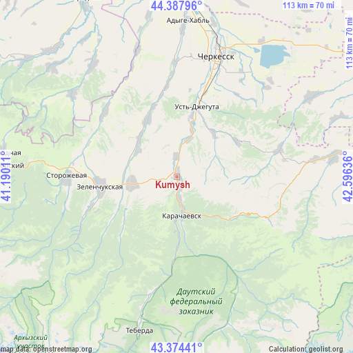
Kumysh GPS coordinates[2]
43° 53' 0.024" North, 41° 53' 35.628" East
| Map corner | latitude | longitude |
|---|---|---|
| Upper-left | 44.38796°, | 41.19011° |
| Center: | 43.88334°, | 41.89323° |
| Lower-right: | 43.37441°, | 42.59636° |
| Map W x H: | 112.7×112.7 km | = 70×70mi |
| max Lat: | 73.50819° ⇑92.4% North |
| Kumysh: | 43.88334° |
| min Lat: | ⇓7.6% South 41.28413° |
| min Long | Kumysh | max Long |
| -179.12198° | 41.89323° | 179.35046° |
| W 39.8%⇐ | ⇒60.2% E |
Elevation
Elevation of Kumysh is 788 m = 2585 ft, and this is 585.4 m = 1921 ft above average elevation for this country.
| Max E: |
2518 m = 8261 ft | 2.8% |
| Kumysh | 788 m 2585 ft | |
| Avg. | 202.6 m = 665 ft | |
Min E: |
-28 m = -92 ft | 97.2% |
See also: Russia elevation on elevation.city.
Geographical zone
Kumysh is located in North temperate zone (between Tropic of Cancer and the Arctic Circle). Distance of this Northern Tropic circle is 2273.5 km =1412.7 mi to South.| Distance of | km | miles | from Kumysh |
|---|---|---|---|
| North Pole | 5127.7 | 3186.2 | to North |
| Arctic Circle | 2521.8 | 1567 | to North |
| Tropic Cancer | 2273.5 | 1412.7 | to South |
| Equator | 4879.4 | 3031.9 | to South |


Nearby cities:
15 places around Kumysh: (largest is in red/bold)
• Ali-Berdukovskiy
16.9 km =10.5 mi,  314°
314°
• Cherkessk
40 km =24.9 mi,  19°
19°
• Druzhba
36.1 km =22.4 mi, 15°
• Ispravnaya
30.6 km =19 mi, 312°
• Karachayevsk
12.3 km =7.6 mi,  172°
172°
• Kardonikskaya
14.5 km =9 mi,  262°
262°
• Khabez
20.3 km =12.6 mi,  331°
331°
• Kyzyl-Oktyabr’skiy
10.7 km =6.6 mi,  233°
233°
• Novyy Karachay
7 km =4.3 mi, 173°
• Ordzhonikidzevskiy
4.6 km =2.9 mi,  176°
176°
• Pravokubanskiy
3.8 km =2.4 mi,  349°
349°
• Sary-Tyuz
2.1 km =1.3 mi,  4°
4°
• Storozhevaya
35.4 km =22 mi,  269°
269°
• Ust’-Dzheguta
23.2 km =14.4 mi, 16°
• Zelenchukskaya
24.5 km =15.2 mi, 263°
Sources, notices
• [Note1] Compared only with cities in Russia existing in our database
• [Src1] Map data: © OpenStreetMap contributors (CC-BY-SA)
• [Src2] Other city data from geonames.org with taken over terms of usage.
• [Src3] Geographical zone / Annual Mean Temperature by Robert A. Rohde @ Wikipedia
