Kukushtan geodata
Kukushtan (Perm) is a populated place; located in Russia in Asia/Yekaterinburg (GMT+5) time zone. With population of 4,870 people, there are 2717 cities with bigger population in this country. Compared to other cities in Russia, 80.7% of cities are located further ↓South; 68.1% of cities are located further ←West and 53.1% of cities have lower elevation than Kukushtan. Note1


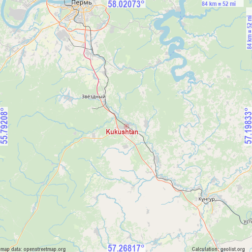
Kukushtan GPS coordinates[2]
57° 38' 47.04" North, 56° 29' 42.72" East
| Map corner | latitude | longitude |
|---|---|---|
| Upper-left | 58.02073°, | 55.79208° |
| Center: | 57.6464°, | 56.4952° |
| Lower-right: | 57.26817°, | 57.19833° |
| Map W x H: | 83.7×83.7 km | = 52×52mi |
| max Lat: | 73.50819° ⇑19.3% North |
| Kukushtan: | 57.6464° |
| min Lat: | ⇓80.7% South 41.28413° |
| min Long | Kukushtan | max Long |
| -179.12198° | 56.4952° | 179.35046° |
| W 68.1%⇐ | ⇒31.9% E |
Elevation
Elevation of Kukushtan is 152 m = 499 ft, and this is 50.6 m = 166 ft below average elevation for this country.
| Max E: |
2518 m = 8261 ft | 46.9% |
| Avg. | 202.6 m = 665 ft | |
| Kukushtan | 152 m = 499 ft | |
Min E: |
-28 m = -92 ft | 53.1% |
See also: Russia elevation on elevation.city.
Geographical zone
Kukushtan is located in North temperate zone (between Tropic of Cancer and the Arctic Circle). Distance of this North polar circle is 991.5 km =616.1 mi to North.| Distance of | km | miles | from Kukushtan |
|---|---|---|---|
| North Pole | 3597.4 | 2235.3 | to North |
| Arctic Circle | 991.5 | 616.1 | to North |
| Tropic Cancer | 3803.8 | 2363.6 | to South |
| Equator | 6409.7 | 3982.8 | to South |


Nearby cities:
15 places around Kukushtan: (largest is in red/bold)
• Bershet’
11.7 km =7.3 mi,  323°
323°
• Ferma
30.5 km =19 mi,  338°
338°
• Filippovka
39 km =24.2 mi,  126°
126°
• Froly
33.3 km =20.7 mi, 336°
• Gamovo
33.6 km =20.9 mi, 316°
• Kondratovo
43.7 km =27.2 mi,  328°
328°
• Kultayevo
43.1 km =26.8 mi,  309°
309°
• Kungur
36.2 km =22.5 mi, 130°
• Lobanovo
26.3 km =16.3 mi, 334°
• Novyye Lyady
46 km =28.6 mi,  8°
8°
• Perm
43 km =26.7 mi, 340°
• Sokol
40 km =24.9 mi, 318°
• Sylva
46 km =28.6 mi,  20°
20°
• Yug
21.3 km =13.2 mi,  295°
295°
• Zvëzdnyy
14.4 km =8.9 mi, 311°
Sources, notices
• [Note1] Compared only with cities in Russia existing in our database
• [Src1] Map data: © OpenStreetMap contributors (CC-BY-SA)
• [Src2] Other city data from geonames.org with taken over terms of usage.
• [Src3] Geographical zone / Annual Mean Temperature by Robert A. Rohde @ Wikipedia
