Konstantinovskaya geodata
Konstantinovskaya (Stavropol’ Kray) is a populated place; located in Russia in Europe/Moscow (GMT+3) time zone. With population of 7,137 people, there are 1966 cities with bigger population in this country. Compared to other cities in Russia, 91.6% of cities are located further ↑North; 56.1% of cities are located further →East and 89.7% of cities have lower elevation than Konstantinovskaya. Note1


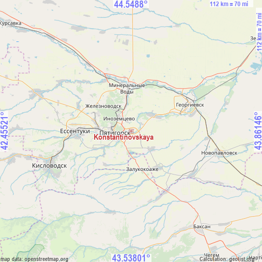
Konstantinovskaya GPS coordinates[2]
44° 2' 44.016" North, 43° 9' 29.988" East
| Map corner | latitude | longitude |
|---|---|---|
| Upper-left | 44.5488°, | 42.45521° |
| Center: | 44.04556°, | 43.15833° |
| Lower-right: | 43.53801°, | 43.86146° |
| Map W x H: | 112.4×112.4 km | = 69.8×69.8mi |
| max Lat: | 73.50819° ⇑91.6% North |
| Konstantinovskaya: | 44.04556° |
| min Lat: | ⇓8.4% South 41.28413° |
| min Long | Konstantinovska | max Long |
| -179.12198° | 43.15833° | 179.35046° |
| W 43.9%⇐ | ⇒56.1% E |
Elevation
Elevation of Konstantinovskaya is 445 m = 1460 ft, and this is 242.4 m = 795 ft above average elevation for this country.
| Max E: |
2518 m = 8261 ft | 10.3% |
| Konstantinovskaya | 445 m 1460 ft | |
| Avg. | 202.6 m = 665 ft | |
Min E: |
-28 m = -92 ft | 89.7% |
See also: Russia elevation on elevation.city.
Geographical zone
Konstantinovskaya is located in North temperate zone (between Tropic of Cancer and the Arctic Circle). Distance of this Northern Tropic circle is 2291.5 km =1423.9 mi to South.| Distance of | km | miles | from Konstantinovskaya |
|---|---|---|---|
| North Pole | 5109.7 | 3175 | to North |
| Arctic Circle | 2503.8 | 1555.8 | to North |
| Tropic Cancer | 2291.5 | 1423.9 | to South |
| Equator | 4897.4 | 3043.1 | to South |


Nearby cities:
15 places around Konstantinovskaya: (largest is in red/bold)
• Etoka
16.6 km =10.3 mi,  212°
212°
• Goryachevodskiy
5.8 km =3.6 mi,  245°
245°
• Inozemtsevo
7.5 km =4.7 mi,  314°
314°
• Lermontov
16.3 km =10.1 mi,  294°
294°
• Lysogorskaya
11.6 km =7.2 mi,  54°
54°
• Novoterskiy
12.6 km =7.8 mi,  335°
335°
• Podkumskiy
5.3 km =3.3 mi, 51°
• Pyatigorsk
7.9 km =4.9 mi,  272°
272°
• Pyatigorskiy
11.3 km =7 mi,  134°
134°
• Svobody
8.9 km =5.5 mi,  255°
255°
• Vinsady
15.9 km =9.9 mi,  284°
284°
• Yutsa
15.3 km =9.5 mi,  229°
229°
• Zalukokoazhe
16.4 km =10.2 mi,  163°
163°
• Zheleznovodsk
15.2 km =9.4 mi, 313°
• Zmeyka
11.2 km =7 mi, 344°
Sources, notices
• [Note1] Compared only with cities in Russia existing in our database
• [Src1] Map data: © OpenStreetMap contributors (CC-BY-SA)
• [Src2] Other city data from geonames.org with taken over terms of usage.
• [Src3] Geographical zone / Annual Mean Temperature by Robert A. Rohde @ Wikipedia
