Kanayevka geodata
Kanayevka (Penza) is a populated place; located in Russia in Europe/Moscow (GMT+3) time zone. With population of 1,934 people, there are 4202 cities with bigger population in this country. Compared to other cities in Russia, 62.2% of cities are located further ↑North; 51.6% of cities are located further ←West and 61.6% of cities have lower elevation than Kanayevka. Note1


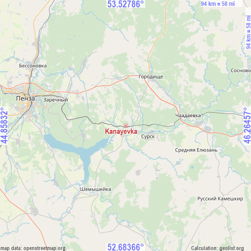
Kanayevka GPS coordinates[2]
53° 6' 28.188" North, 45° 33' 41.184" East
| Map corner | latitude | longitude |
|---|---|---|
| Upper-left | 53.52786°, | 44.85832° |
| Center: | 53.10783°, | 45.56144° |
| Lower-right: | 52.68366°, | 46.26457° |
| Map W x H: | 93.9×93.9 km | = 58.3×58.3mi |
| max Lat: | 73.50819° ⇑62.2% North |
| Kanayevka: | 53.10783° |
| min Lat: | ⇓37.8% South 41.28413° |
| min Long | Kanayevka | max Long |
| -179.12198° | 45.56144° | 179.35046° |
| W 51.6%⇐ | ⇒48.4% E |
Elevation
Elevation of Kanayevka is 173 m = 568 ft, and this is 29.6 m = 97 ft below average elevation for this country.
| Max E: |
2518 m = 8261 ft | 38.4% |
| Avg. | 202.6 m = 665 ft | |
| Kanayevka | 173 m = 568 ft | |
Min E: |
-28 m = -92 ft | 61.6% |
See also: Russia elevation on elevation.city.
Geographical zone
Kanayevka is located in North temperate zone (between Tropic of Cancer and the Arctic Circle). Distance of this North polar circle is 1496.1 km =929.6 mi to North.| Distance of | km | miles | from Kanayevka |
|---|---|---|---|
| North Pole | 4102 | 2548.9 | to North |
| Arctic Circle | 1496.1 | 929.6 | to North |
| Tropic Cancer | 3299.1 | 2050 | to South |
| Equator | 5905 | 3669.2 | to South |


Nearby cities:
15 places around Kanayevka: (largest is in red/bold)
• Bessonovka
41.3 km =25.7 mi,  302°
302°
• Chaadayevka
23.7 km =14.7 mi,  80°
80°
• Chemodanovka
25.1 km =15.6 mi, 303°
• Gorodishche
21.1 km =13.1 mi,  26°
26°
• Grabovo
45.4 km =28.2 mi,  313°
313°
• Kondol’
46.6 km =29 mi,  226°
226°
• Makhalino
44.1 km =27.4 mi,  93°
93°
• Penza
38.5 km =23.9 mi,  285°
285°
• Russkiy Kameshkir
44.8 km =27.8 mi,  128°
128°
• Shemysheyka
26.5 km =16.5 mi,  205°
205°
• Srednyaya Yelyuzan’
27.8 km =17.3 mi,  109°
109°
• Sursk
9 km =5.6 mi, 113°
• Verkhozim
45 km =28 mi,  192°
192°
• Zarechnyy
26.8 km =16.7 mi, 293°
• Zasechnoye
32.2 km =20 mi,  270°
270°
Sources, notices
• [Note1] Compared only with cities in Russia existing in our database
• [Src1] Map data: © OpenStreetMap contributors (CC-BY-SA)
• [Src2] Other city data from geonames.org with taken over terms of usage.
• [Src3] Geographical zone / Annual Mean Temperature by Robert A. Rohde @ Wikipedia
